Bayshore Blvd with Potrero Hill: Difference between revisions
No edit summary |
(added photo and category) |
||
| (15 intermediate revisions by 4 users not shown) | |||
| Line 1: | Line 1: | ||
'''<font face = arial light> <font color = maroon> <font size = 3>Unfinished History</font></font> </font>''' | |||
[[Image:Widening-Bayshore-Boulevard-for-Maintenance-of-Streetcar-Right-of-Way- March-31-1933 U13906.jpg]] | |||
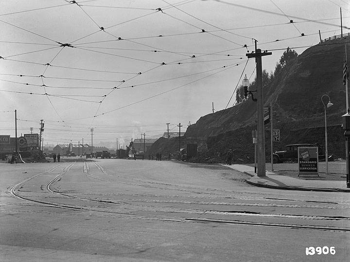
'''Bayshore Boulevard with Potrero Hill visible in background just north of Cesar Chavez Street (formerly Army Street)''' | '''Widening Bayshore Blvd at then-Army Street to work on streetcar right of way, March 31, 1933.''' | ||
''Photo: [http://www.sfmta.com/photo SFMTA Photo Archive U13906]'' | |||
[[Image:H-line-Bayshore-blvd-1930s.jpg]] | |||
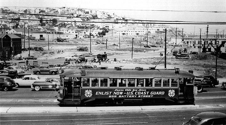
'''1935 Bayshore Boulevard with Potrero Hill visible in background just north of Cesar Chavez Street (formerly Army Street)''' | |||
''Photo: Private Collection, San Francisco, CA'' | |||
[[Image:North-from-San-Bruno-and-Costa-1924-AAB-5254.jpg]] | |||
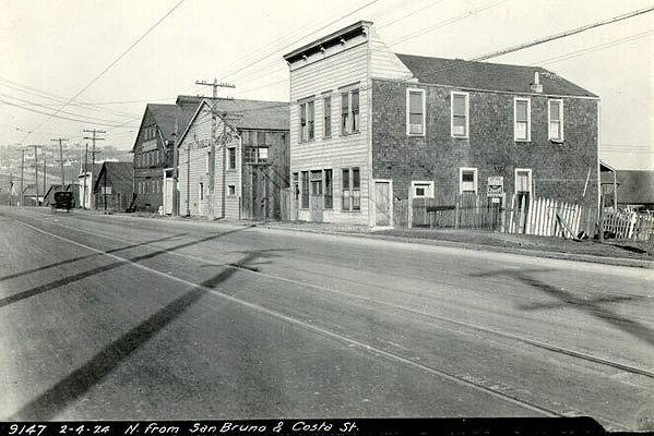
'''This 1924 photo [[San Bruno and Cortland|looking north]] on San Bruno at Costa, just east of Bernal, is now buried under the Highway 101 freeway.''' | |||
''Photo San Francisco History Center, San Francisco Public Library'' | |||
[[Image:Bayshore-Blvd-south-near-Cortland-at-right-1929-SFPL.jpg|720px]] | |||
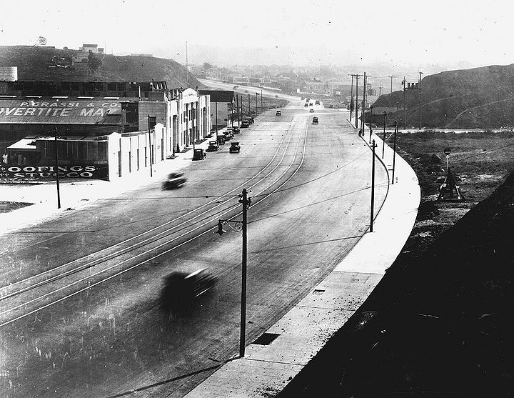
'''Bayshore Blvd south near Cortland at right, 1929.''' | |||
''Photo: San Francisco History Center, San Francisco Public Library'' | |||
[[Image:Bayshore-blvd-looking-south-at-Oakdale-1929.jpg]] | |||
'''Bayshore Boulevard looking south at Oakdale, 1929.''' | |||
''Photo: Shaping San Francisco'' | |||
[[Image:Oakdale-and-Bayshore-2009 9109.jpg]] | |||
'''Bayshore Boulevard looking south at Oakdale, 2009.''' | |||
''Photo: Chris Carlsson'' | |||
[[Image:bayvwhp$bayshore-blvd-1929.jpg]] | |||
'''1929 Looking down Bayshore Boulevard toward Potrero Hill''' | |||
''Photo: Private Collection, San Francisco, CA'' | |||
[[Image:bayvwhp$bayshore-blvd-1994.jpg]] | [[Image:bayvwhp$bayshore-blvd-1994.jpg]] | ||
'''1994''' | '''1994 Looking down Bayshore Boulevard toward Potrero Hill''' | ||
''Photo: David Green'' | |||
[[Image:Bayshore-Boulevard-and-Cortland-Avenue-Looking-North November-27-1933 U14335.jpg]] | |||
[ | '''Bayshore Blvd. and Cortland looking north, Nov. 27, 1933.''' | ||
''Photo: [http://www.sfmta.com/photo SFMTA Photo Archive U14335]'' | |||
[[Image:Oakdale-near-Quint-1865 wnp26.jpg]] | |||
'''Oakdale near Quint Street, 1865.''' | |||
'' | ''Photo: courtesy OpenSFHistory.org'' | ||
[[Brief History of Bayview-Hunters Point |Prev. Document]] [[Winemaking in the Bayview |Next Document]] | |||
[[ | [[category:Bayview/Hunter's Point]] [[category:Potrero Hill]] [[category:1930s]] [[category:1920s]] [[category:1990s]] [[category:Transit]] [[category:2000s]] [[category:roads]] [[category:Bernal Heights]] [[category:1860s]] | ||
Latest revision as of 21:00, 13 September 2018
Unfinished History
Widening Bayshore Blvd at then-Army Street to work on streetcar right of way, March 31, 1933.
Photo: SFMTA Photo Archive U13906
1935 Bayshore Boulevard with Potrero Hill visible in background just north of Cesar Chavez Street (formerly Army Street)
Photo: Private Collection, San Francisco, CA
This 1924 photo looking north on San Bruno at Costa, just east of Bernal, is now buried under the Highway 101 freeway.
Photo San Francisco History Center, San Francisco Public Library
Bayshore Blvd south near Cortland at right, 1929.
Photo: San Francisco History Center, San Francisco Public Library
Bayshore Boulevard looking south at Oakdale, 1929.
Photo: Shaping San Francisco
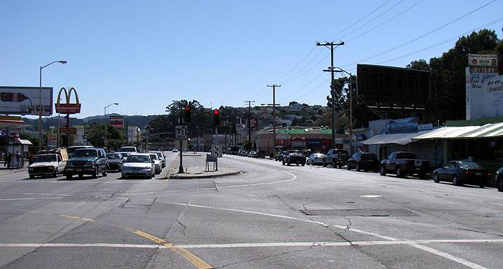
Bayshore Boulevard looking south at Oakdale, 2009.
Photo: Chris Carlsson
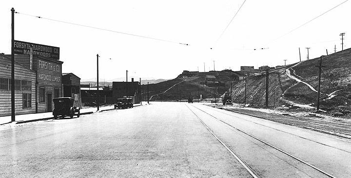
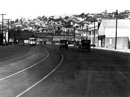
1929 Looking down Bayshore Boulevard toward Potrero Hill
Photo: Private Collection, San Francisco, CA
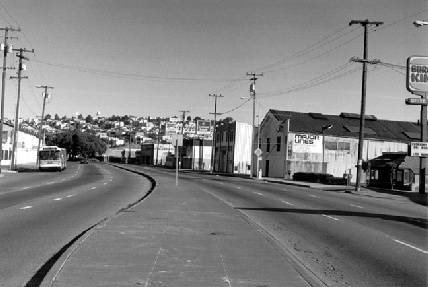
1994 Looking down Bayshore Boulevard toward Potrero Hill
Photo: David Green
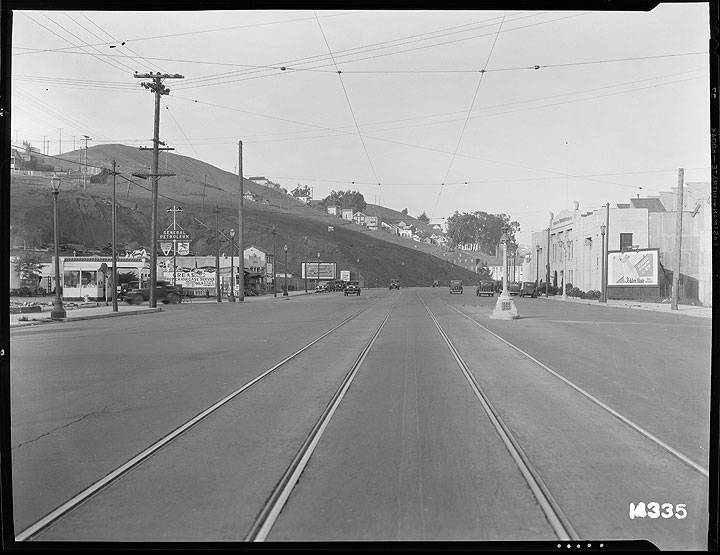
Bayshore Blvd. and Cortland looking north, Nov. 27, 1933.
Photo: SFMTA Photo Archive U14335
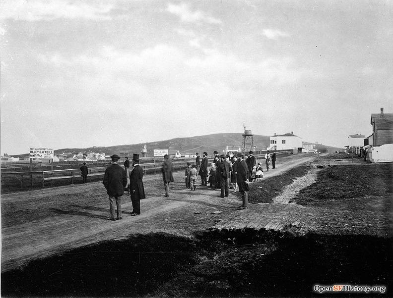
Oakdale near Quint Street, 1865.
Photo: courtesy OpenSFHistory.org

