Redevelopment Maps: Difference between revisions
No edit summary |
No edit summary |
||
| Line 9: | Line 9: | ||
[[Image:SFRDA-projects-all qap97r86wzrd0194.jpg]] | [[Image:SFRDA-projects-all qap97r86wzrd0194.jpg]] | ||
[[category:Redevelopment]] [[category:Real estate]] [[category:Downtown]] [[category:SOMA]] [[ | [[category:Redevelopment]] [[category:Real estate]] [[category:Downtown]] [[category:SOMA]] [[category:Diamond Heights]] [[category:Western Addition]] [[category:Bayview/Hunter's Point]] [[category:Mission Bay]] [[category:1960s]] [[category:1970s]] [[category:1980s]] [[category:1990s]] [[category:2000s]] | ||
Latest revision as of 22:13, 16 June 2020
Primary Source
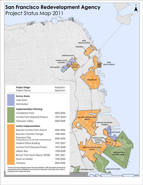
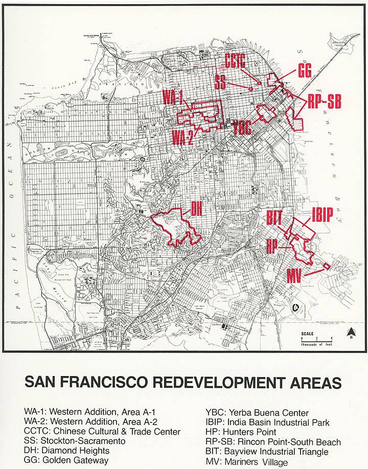
The San Francisco Redevelopment Agency ceased to exist February 1, 2012 after Governor Jerry Brown moved to shut down all Redevelopment Agencies in California in 2011 as a means to address the state's severe budget crisis at the time. Here are two maps showing the zones that had been under the control of the SFRDA process during the years prior to the agency's demise.
This map in 2011 shows an expanded area of San Francisco Redevelopment Agency projects slated for Bayview/Hunters Point, compared to the map below, which was prepared some years earlier.


