Islais Creek Remembered: Difference between revisions
(fixed navigation for new page) |
No edit summary |
||
| (6 intermediate revisions by 2 users not shown) | |||
| Line 7: | Line 7: | ||
'''Islais Creek emerging from Glen Canyon, 1890s.''' | '''Islais Creek emerging from Glen Canyon, 1890s.''' | ||
''Photo: | ''Photo: Private Collection, San Francisco, CA'' | ||
[[Image: | [[Image:Wnp27.0484 islais creek near geneva car barn.jpg]] | ||
'''View of Islais Creek in 1918 disappearing into culvert in 1918, not far from the Geneva Car barn. Sutro Forest covers part of Mt. Davidson in upper left.''' | '''View of Islais Creek in 1918 disappearing into culvert in 1918, not far from the Geneva Car barn. Sutro Forest covers part of Mt. Davidson in upper left.''' | ||
''Photo: | ''Photo: [http://opensfhistory.org/Display/wnp27.0484.jpg OpenSFHistory] / wnp27.0484.jpg '' | ||
[[Image: | [[Image:Islais-creek-dec-26-2010 2130.jpg]] | ||
[[Image:Islais-creek-dec-26-2010 2128.jpg]] | |||
'''Islais Creek in [[Glen Canyon Natural History|Glen Canyon]], Dec. 26, 2010.''' | |||
''Photos: Chris Carlsson'' | |||
[[Image:Wnp36.03617 islais creek reclamation district.jpg]] | |||
'''1920's image of the [[Islais Creek wetlands|Islais Creek Reclamation District]] which has become the industrial zone between Bayshore Blvd. and 3rd Street.''' | '''1920's image of the [[Islais Creek wetlands|Islais Creek Reclamation District]] which has become the industrial zone between Bayshore Blvd. and 3rd Street.''' | ||
''Photo: | ''Photo: [http://opensfhistory.org/Display/wnp36.03617.jpg OpenSFHistory] / wnp36.03617.jpg'' | ||
[[Image:Islais wetlands1.jpg]] | [[Image:Islais wetlands1.jpg]] | ||
''Photo: | ''Photo: Private Collection, San Francisco, CA'' | ||
[[Image:June 26 1931 Islais fill-Potrero Hill dpwbook46 dpwA3035 View west from 3rd Street bridge wnp36.03873.jpg|800px]] | |||
'''June 26, 1931, Islais Creek landfill site. Gas tank and Potrero Hill to right.''' | |||
''Photo: OpenSFHistory.org wnp36.03873'' | |||
<font size=4>Islais Creek Remembered</font size> | |||
"Islais Creek fascinated us. Located east of what is today Highway 280, this huge area of marshland, full of numerous stagnant ponds and junk of all kinds, fed by streams of water from the hills, attracted us as a magnet does a nail. It was in this marshland that we boys would go rafting, sailing the malodorous waters as though we were jolly tars on the Spanish Main. | "Islais Creek fascinated us. Located east of what is today Highway 280, this huge area of marshland, full of numerous stagnant ponds and junk of all kinds, fed by streams of water from the hills, attracted us as a magnet does a nail. It was in this marshland that we boys would go rafting, sailing the malodorous waters as though we were jolly tars on the Spanish Main. | ||
| Line 40: | Line 54: | ||
''--Excerpted from Frank R. Quinn's 1984 memoir, '''Growing Up in the Mission'''''. | ''--Excerpted from Frank R. Quinn's 1984 memoir, '''Growing Up in the Mission'''''. | ||
[[Image:View Northwest from Islais Creek Bridge, 3rd Street. Duncanson-Harrelson Co. cranes, F. E. Booth Company (sardine cannery), Cargill warehouses. Potrero Hill with public housing in distance 1950s wnp37.03830.jpg|800px]] | |||
'''1950 view northwest from 3rd Street bridge over Islais Creek. Potrero Hill and public housing in distance. | |||
''Photo: OpenSFHistory.org wnp37.03830'' | |||
[[Image:watrtour$islais-creek-west-end.jpg]] | [[Image:watrtour$islais-creek-west-end.jpg]] | ||
| Line 59: | Line 79: | ||
''photo: Chris Carlsson'' | ''photo: Chris Carlsson'' | ||
[[Image:Aug 20 1948 Southern Pacific Railroad, Islais Creek (Section 022 of 190 - 1948 Aerial Survey of San Francisco) wnp31.1948.022.jpg|800px]] | |||
'''August 20, 1948, aerial view of Southern Pacific Railroad and Islais Creek.''' | |||
''Photo: OpenSFHistory.org wnp31.1948.022'' | |||
<hr> | <hr> | ||
| Line 67: | Line 92: | ||
[[category:Bayview/Hunter's Point]][[category:Ecology]][[category:Water]][[category:1920s]] [[category:1930s]] [[category:1990s]] [[category:shoreline]] | [[category:Bayview/Hunter's Point]][[category:Ecology]][[category:Water]][[category:1920s]] [[category:1930s]] [[category:1940s]] [[category:1990s]] [[category:shoreline]] [[category:1950s]] [[category:2010s]] [[category:Glen Park]] | ||
Latest revision as of 17:13, 8 July 2020
"I was there..."
by Frank R. Quinn
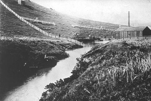
Islais Creek emerging from Glen Canyon, 1890s.
Photo: Private Collection, San Francisco, CA
View of Islais Creek in 1918 disappearing into culvert in 1918, not far from the Geneva Car barn. Sutro Forest covers part of Mt. Davidson in upper left.
Photo: OpenSFHistory / wnp27.0484.jpg
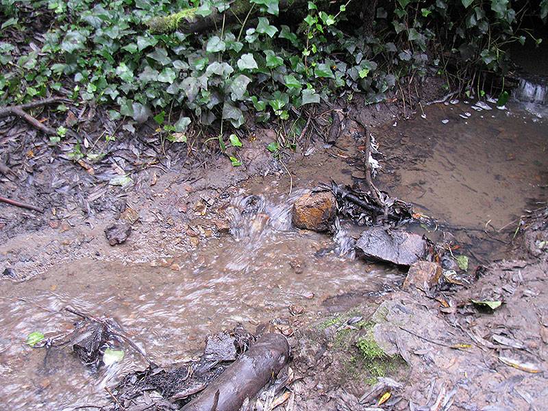
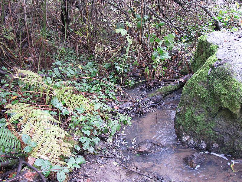
Islais Creek in Glen Canyon, Dec. 26, 2010.
Photos: Chris Carlsson
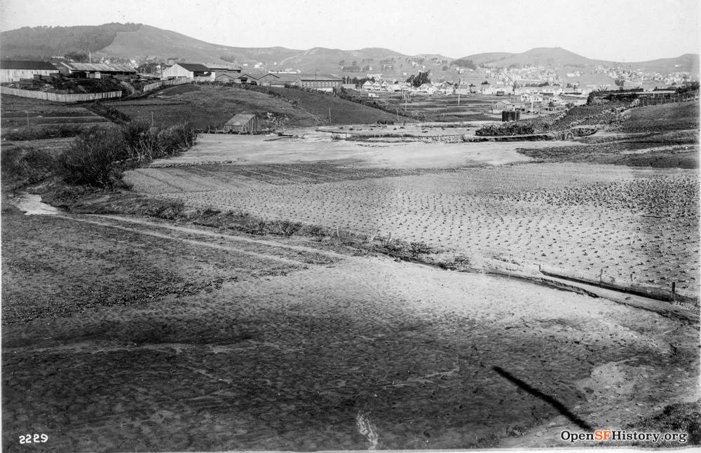
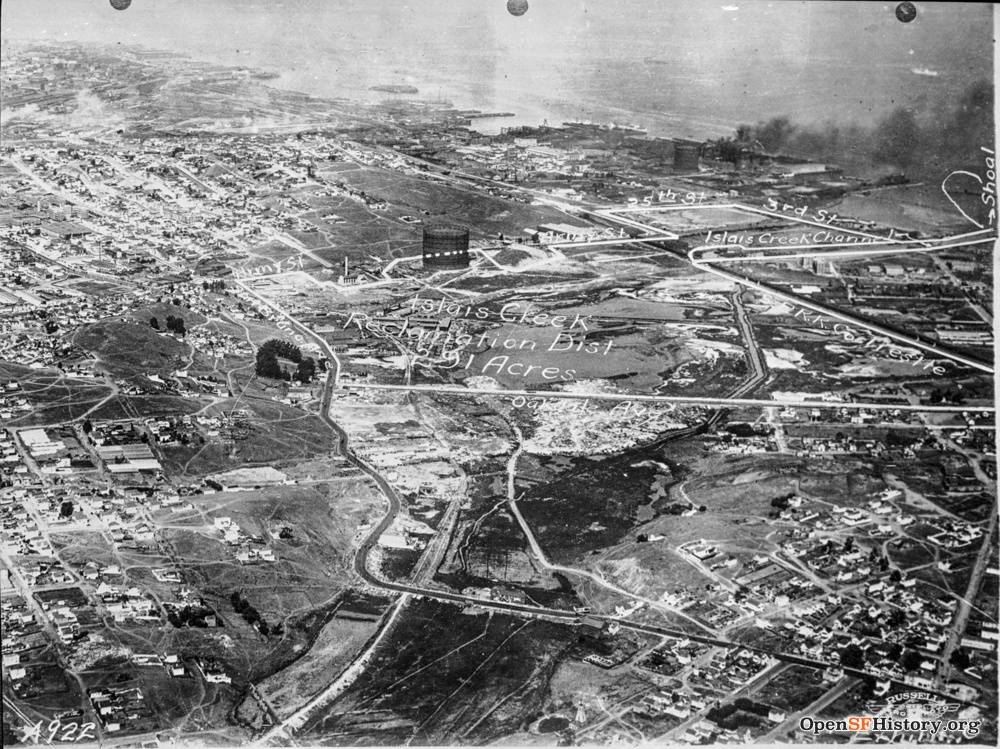
1920's image of the Islais Creek Reclamation District which has become the industrial zone between Bayshore Blvd. and 3rd Street.
Photo: OpenSFHistory / wnp36.03617.jpg
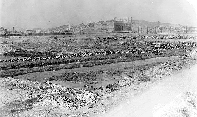
Photo: Private Collection, San Francisco, CA
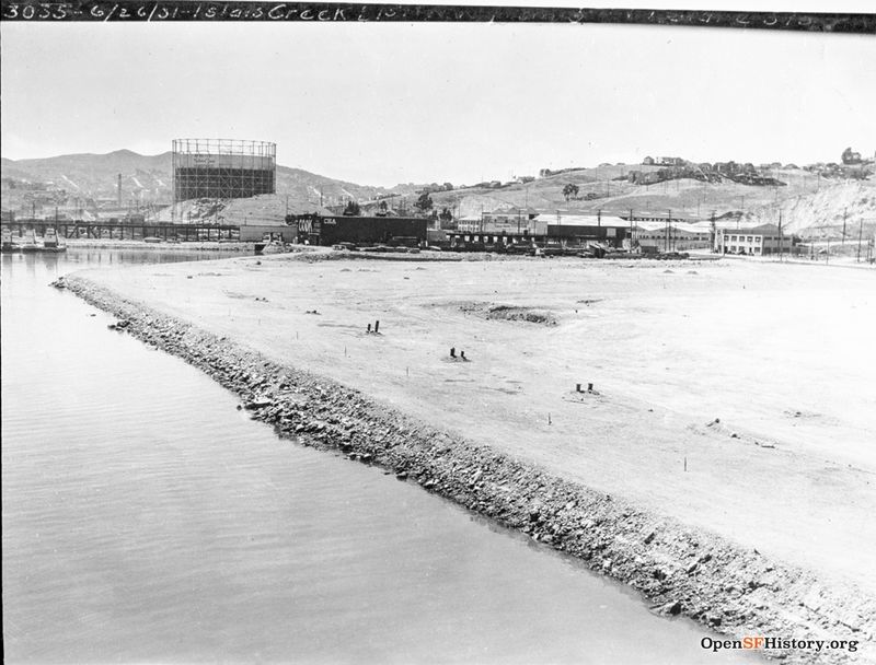
June 26, 1931, Islais Creek landfill site. Gas tank and Potrero Hill to right.
Photo: OpenSFHistory.org wnp36.03873
Islais Creek Remembered
"Islais Creek fascinated us. Located east of what is today Highway 280, this huge area of marshland, full of numerous stagnant ponds and junk of all kinds, fed by streams of water from the hills, attracted us as a magnet does a nail. It was in this marshland that we boys would go rafting, sailing the malodorous waters as though we were jolly tars on the Spanish Main.
"One particular Saturday morning disaster struck when I accidentally fell into the pond from a makeshift raft. I was soaked through and through. My companions, anxious to help me, rigged up a makeshift clothesline. I took off my wet clothes and draped them across the line. Just where and how they found the rope and material to make a clothesline I will never know. At that sad moment I had no desire to make inquiries.
"To accelerate the drying of my garments they built a merry fire under them. That was when the BIG trouble started. My clothing caught on fire. Oh what a lovely fire my attire made! By sheer luck I managed to rescue my trousers and shoes.
"The generosity of my companions endured. One loaned me his 'roughneck' sweater, and dressed in shoes, trousers and sweater we made our way home. When my father learned of my luckless adventure he gave me a lecture. (It's a wonder he didn't break my neck!)
"Today that area is built up. So much the better. A cousin of my mother's, many years ago, was brought home dead after drowning in a pond in Islais Creek."
Islais Creek was fed, in part, by a stream that flowed down from the hills by way of what is today Alemany Boulevard. It was in this creek that we boys would catch pollywogs and bring them home, much to the consternation of our mothers. Mothers failed to find the creatures to be an adornment to their households. Today that stream is a busy highway carrying a heavy stream of automotive traffic.
--Excerpted from Frank R. Quinn's 1984 memoir, Growing Up in the Mission.
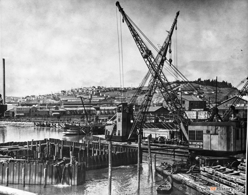
1950 view northwest from 3rd Street bridge over Islais Creek. Potrero Hill and public housing in distance.
Photo: OpenSFHistory.org wnp37.03830
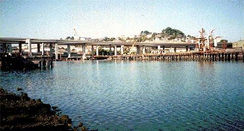
Islais Creek is now an estuary with I-280 passing over it. The old Copra loading dock is visible on the right side of this image from 1996.
photo: Chris Carlsson
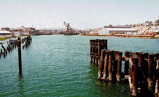
Islais Creek in the mid-1990s looking west.
photo: Chris Carlsson
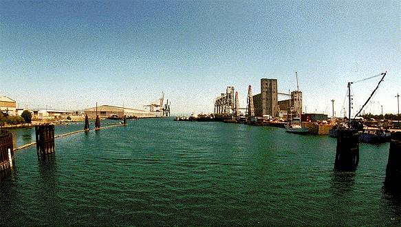
Islais Creek looking east.
photo: Chris Carlsson
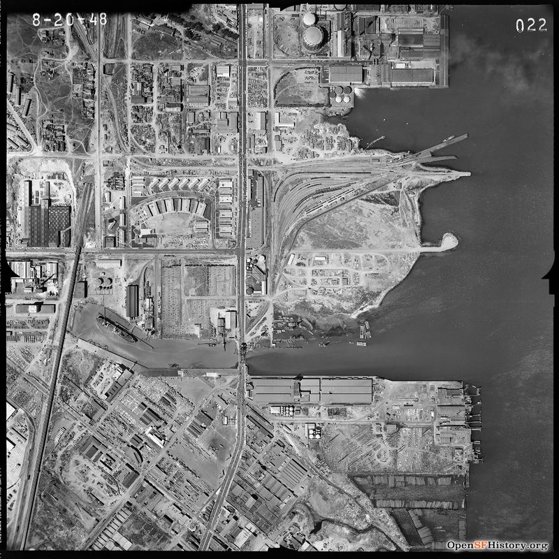
August 20, 1948, aerial view of Southern Pacific Railroad and Islais Creek.
Photo: OpenSFHistory.org wnp31.1948.022

