The Medical Industry: Difference between revisions
m (Added current photo of St. Mary's Hospital.) |
(UCSF Parnassus Campus. 2023. sharpened.jpg) |
||
| (10 intermediate revisions by the same user not shown) | |||
| Line 12: | Line 12: | ||
''Photo: Private Collection, San Francisco, CA'' | ''Photo: Private Collection, San Francisco, CA'' | ||
[[Image:UCSF Parnassus Campus. 2023. sharpened.jpg]] | |||
'''UC Medical Center Parnassus Campus 2023, below Sutro Forest''' | |||
''Photo: Eihway Su'' | |||
[[Image:Parnassus-Heiughts-and-Kezar-stadium-northeast-from-6th-and-Judah-at-bottom-Sept-6-1927.jpg|720px]] | [[Image:Parnassus-Heiughts-and-Kezar-stadium-northeast-from-6th-and-Judah-at-bottom-Sept-6-1927.jpg|720px]] | ||
| Line 43: | Line 49: | ||
''Photo: OpenSFHistory.org wnp15.1628'' | ''Photo: OpenSFHistory.org wnp15.1628'' | ||
[[Image: | [[Image:Stanyan and Hayes St Marys Hospital.2023. sharpened.jpg]] | ||
'''St. Mary's Medical Center in 2023.''' | '''St. Mary's Medical Center in 2023.''' | ||
| Line 62: | Line 68: | ||
[[Cole Valley at Turn of 20th Century |Prev. Document]] [[Redevelopment Hits the Haight |Next Document]] | [[Cole Valley at Turn of 20th Century |Prev. Document]] [[Redevelopment Hits the Haight |Next Document]] | ||
[[category:Haight-Ashbury]] [[category: | [[category:Haight-Ashbury]] [[category:1900s]] [[category:1920s]] [[category:1930s]] [[category:1960s]] [[category:1970s]] [[category:2020s]] [[category:Public Health]] [[category:Transit]] | ||
Latest revision as of 20:06, 6 June 2023
Unfinished History
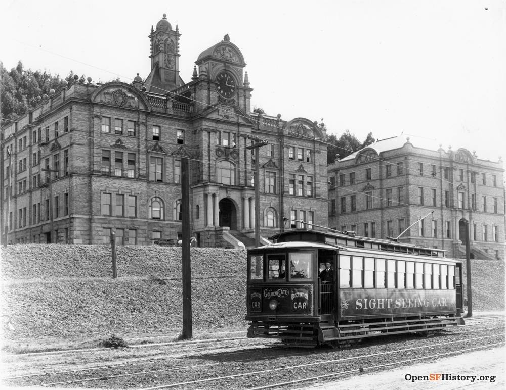
United railroad car passing along Parnassus at Hillway beneath the then-Affiliated Colleges campus, now UC Medical Center, Nov. 15, 1908.
Photo: courtesy OpenSFHistory.org
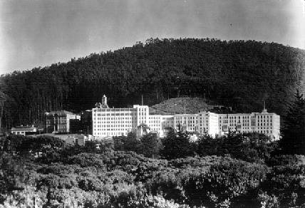
UC Medical Center c. 1925, below Sutro Forest
Photo: Private Collection, San Francisco, CA
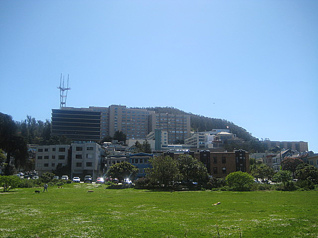
UC Medical Center Parnassus Campus 2023, below Sutro Forest
Photo: Eihway Su
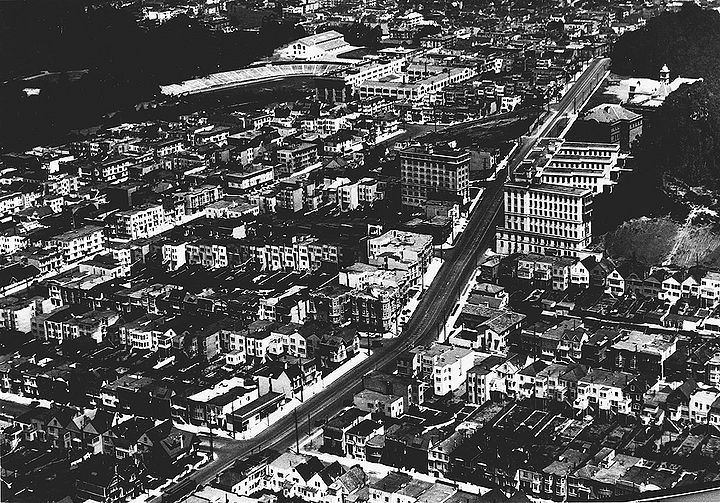
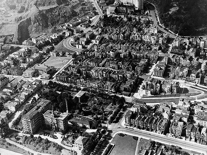
View of Parnassus Heights with UC Medical Center at right, Kezar Stadium at upper left (home to San Francisco 49ers starting in the late 1940s), as seen from above apx. 6th and Judah looking north-northeast, September 6, 1927.
Photo: C. R. collection
The principle forces at work in the Haight-Ashbury, other than the daily lives of the working class, have been the major health institutions that literally define the perimeter of the neighborhood: The University of California at San Francisco, situated on the southwest corner; St. Mary's Hospital on the northwest corner; Harkness Hospital (or Southern Pacific Hospital) on the northeast corner; and St. Joseph's, just behind Buena Vista Park on what would be the southeast corner.
In the 1960s and through the 1970s these health institutions were engaged in major expansion plans that had an extraordinary impact on the daily lives of Haight Ashbury residents, many of whom were employed by the hospitals. St. Mary's and UCSF were the two largest hospitals of their type west of the Mississippi (UCSF was the largest university hospital; St. Mary's, the largest religious hospital). Both were licensed for in excess of 600 beds. The UCSF had a total day time population of about 10,000 people, the vast majority of which commuted every day, thus the demand for a freeway, and a freeway offramp in Golden Gate Park. St. Mary's at the time had about 4 to 5,000 daily visitors. Harkness Hospital at Fell and Baker had substantially less, but nevertheless boasted a bed count of about 200 and a staff of about 400. St. Joseph's was about the same size as Harkness.
—From a lecture by Calvin Welch at New College in Fall, 1994.
St. Mary's from the air, 1970.
Photo: San Francisco History Center, San Francisco Public Library
Construction of St. Mary's, 1971, at Stanyan Street.
Photo: San Francisco History Center, San Francisco Public Library
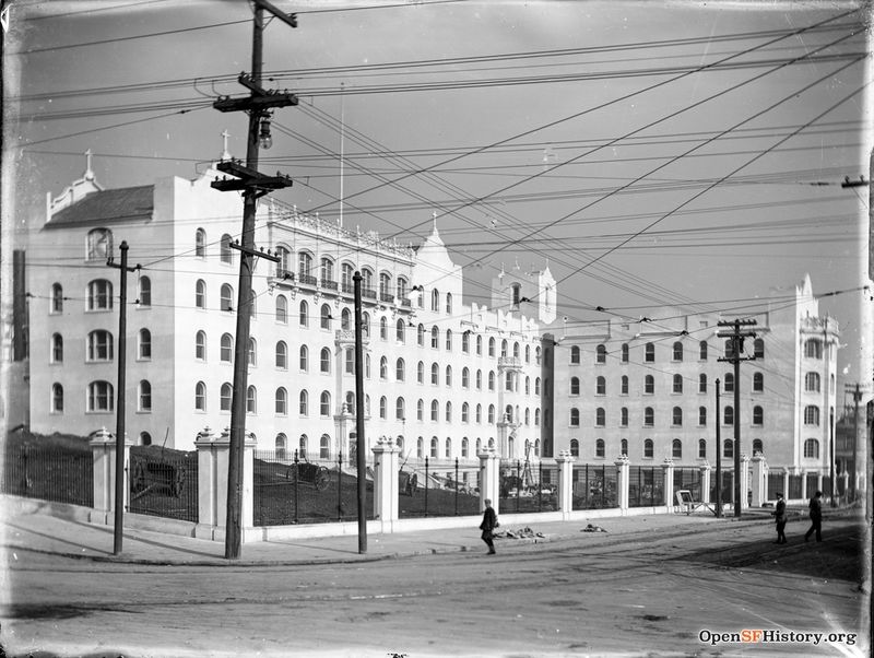
St. Mary's Hospital under construction in 1911.
Photo: OpenSFHistory.org wnp15.1628
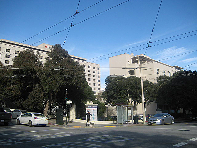
St. Mary's Medical Center in 2023.
Photo: Eihway Su
The biggest employer in San Francisco in the late 1960s and today is health care. In the late 1960s/early 1970s middle class white neighborhoods in the Inner Sunset and the Haight-Ashbury were being threated by hospital expansion. There were at that time in 1970, 25 full service hospitals in San Francisco, each one of which had an expansion plan. UCSF, being a state institution, had total and complete immunity from local land use laws and had the power of eminent domain which they had used to purchase and demolish 500 units of housing in the Inner Sunset to accomplish its growth in the late fifties and early sixties. They bought another 120 units around 1969 and sustained community opposition forced the university to return them to housing use. But they were institutionalized. Across the Panhandle St Mary's Hospital took about 200 units on Shrader and Stanyan streets and did this massive expansion in the very, very early sixties. At that time, the hospital sector was not unionized. During the 1960s it became unionized and there was a very interesting struggle that developed based on an alliance between trade unions and certain community groups that were opposed to hospital expansion.
—From comments made by Calvin Welch at a "History of Housing" discussion, May 10, 2018.
Franklin Medical Center c. 1935, below Corona Heights
Photo: Private Collection, San Francisco, CA

