McCovey Cove: Difference between revisions
No edit summary |
(added photo) |
||
| (3 intermediate revisions by 2 users not shown) | |||
| Line 7: | Line 7: | ||
'''Port walk along then China Basin, now known as McCovey Cove, c. 1930s.''' | '''Port walk along then China Basin, now known as McCovey Cove, c. 1930s.''' | ||
''Photo: | ''Photo: source unknown'' | ||
[[Image:Port-walk-2010-w-raised-3rd-st-bridge 8681.jpg]] | [[Image:Port-walk-2010-w-raised-3rd-st-bridge 8681.jpg]] | ||
| Line 18: | Line 18: | ||
Beyond the Third Street Bridge in both photos hunkers the China Basin Building, built in 1925 by Del Monte Cannery. By 1974, the building had been painted a rich blue. That same year, it was a distribution point of a massive food giveaway conducted by the Hearst family in response to [[SLA Demands "Gesture of Good Faith"|ransom demands of the Symbionese Liberation Army]], the kidnappers of newspaper heiress Patty Hearst. Today the building houses corporate offices, and life science and technology firms that value its proximity to UCSF’s new Mission Bay campus. That a ballpark could be built at a site so key to the economic vitality of an earlier San Francisco reminds us of just how [[A Waterfront Planned: The 1990s and the New Millennium|outmoded The Port had become]] by the late 20th century, left in the wake of the container ship. | Beyond the Third Street Bridge in both photos hunkers the China Basin Building, built in 1925 by Del Monte Cannery. By 1974, the building had been painted a rich blue. That same year, it was a distribution point of a massive food giveaway conducted by the Hearst family in response to [[SLA Demands "Gesture of Good Faith"|ransom demands of the Symbionese Liberation Army]], the kidnappers of newspaper heiress Patty Hearst. Today the building houses corporate offices, and life science and technology firms that value its proximity to UCSF’s new Mission Bay campus. That a ballpark could be built at a site so key to the economic vitality of an earlier San Francisco reminds us of just how [[A Waterfront Planned: The 1990s and the New Millennium|outmoded The Port had become]] by the late 20th century, left in the wake of the container ship. | ||
[[Image:Odoul before park4.jpg]] | |||
'''McCovey Cove when it was still China Basin, 1996.''' | |||
''Photo: Chris Carlsson'' | |||
[[Image:Before park3 from water.jpg]] | |||
'''Look across water at site of Giant's Ballpark in 1996, several years before construction began.''' | |||
''Photo: Chris Carlsson'' | |||
[[Image:soma1$cove-before-ballpark.jpg]] | [[Image:soma1$cove-before-ballpark.jpg]] | ||
| Line 24: | Line 36: | ||
''Photo: Chris Carlsson'' | ''Photo: Chris Carlsson'' | ||
[[Image:China-basin-mission-creek-c-1970-aerial.jpg]] | |||
'''Aerial view in 1970 of China Basin and what later was dubbed "McCovey Cove."''' | |||
''Photo: HistoryofSF Instagram'' | |||
[[Image:soma1$pacbell-and-mccovey-cove.jpg]] | [[Image:soma1$pacbell-and-mccovey-cove.jpg]] | ||
| Line 41: | Line 59: | ||
[[Image:Tours-shoreline.gif|link=WATER LOT SPECULATION]] [[WATER LOT SPECULATION| Continue Shoreline Tour]] | [[Image:Tours-shoreline.gif|link=WATER LOT SPECULATION]] [[WATER LOT SPECULATION| Continue Shoreline Tour]] | ||
[[Mission Creek | [[Mission Creek 1938 aerial |Prev. Document]] [[Pac Bell Ballpark |Next Document]] | ||
[[category:SOMA]] [[category:1990s]] [[category:baseball]] [[category:2000s]] [[category:shoreline]] [[category:Mission Bay]] | [[category:SOMA]] [[category:1990s]] [[category:baseball]] [[category:2000s]] [[category:shoreline]] [[category:Mission Bay]] | ||
Latest revision as of 16:42, 16 September 2024
Historical Essay
by Abigail Johnston / Potrero Hill Archives Project
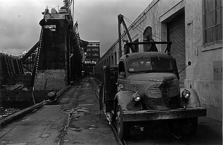
Port walk along then China Basin, now known as McCovey Cove, c. 1930s.
Photo: source unknown
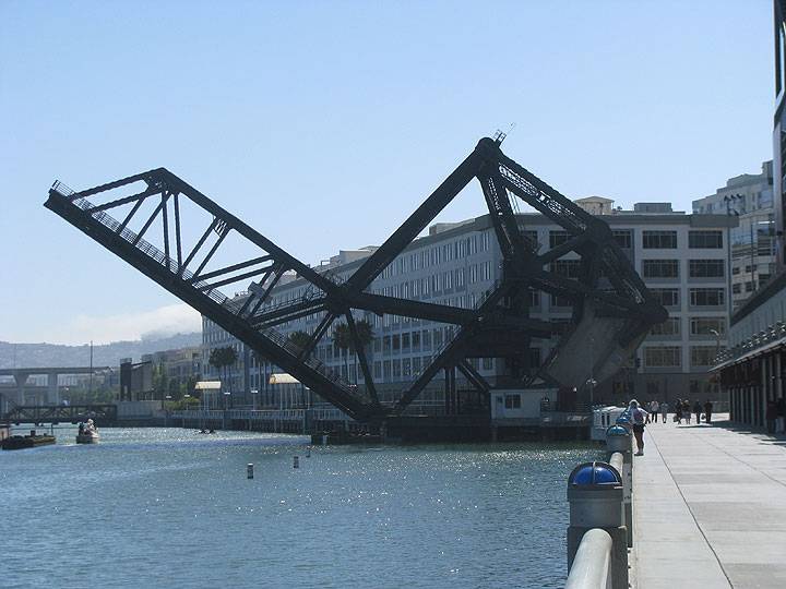
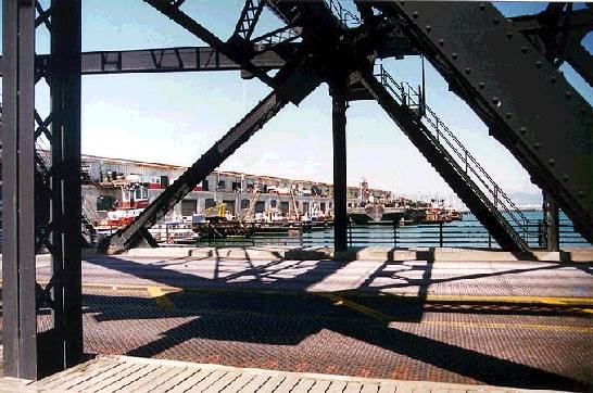
Similar view, July 4, 2010, with the 3rd Street Bridge raised.
Photo: Chris Carlsson
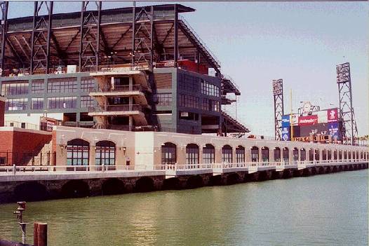
Before Giants fans strolled the Portwalk adjacent to AT&T Park, stevedores and switch locomotives plied the same stretch of pier to move cargo between freighters moored in the China Basin channel and the warehouse located where the ballpark stands today. Pavement set with plaques commemorating the feats of Giants stars has replaced the train tracks, and the stadium’s right field wall mimics the warehouse’s arched windows. On game days, in what is now known as McCovey Cove, ferries deliver fans to the park and kayakers vie for splash hits where a drydock, perhaps on its way to being scrapped, temporarily floated.
Beyond the Third Street Bridge in both photos hunkers the China Basin Building, built in 1925 by Del Monte Cannery. By 1974, the building had been painted a rich blue. That same year, it was a distribution point of a massive food giveaway conducted by the Hearst family in response to ransom demands of the Symbionese Liberation Army, the kidnappers of newspaper heiress Patty Hearst. Today the building houses corporate offices, and life science and technology firms that value its proximity to UCSF’s new Mission Bay campus. That a ballpark could be built at a site so key to the economic vitality of an earlier San Francisco reminds us of just how outmoded The Port had become by the late 20th century, left in the wake of the container ship.
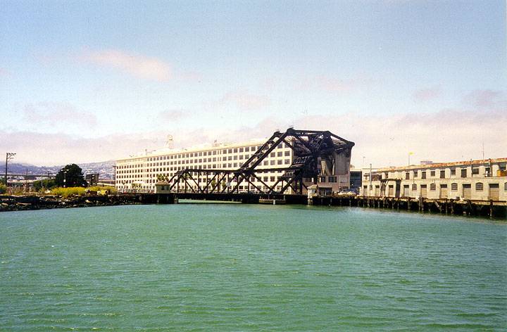
McCovey Cove when it was still China Basin, 1996.
Photo: Chris Carlsson
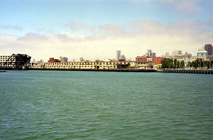
Look across water at site of Giant's Ballpark in 1996, several years before construction began.
Photo: Chris Carlsson
The mouth of Mission Creek, now "McCovey Cove," before the ballpark was built and replaced these warehouses.
Photo: Chris Carlsson
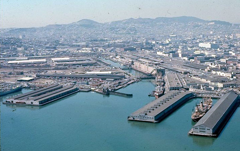
Aerial view in 1970 of China Basin and what later was dubbed "McCovey Cove."
Photo: HistoryofSF Instagram
The ballpark also displaced tugboat docking. The mouth of Mission Creek was christened "McCovey Cove" after the legendary Giants first baseman, and to market the home runs expected to "splash down" in it.
Photo: Chris Carlsson
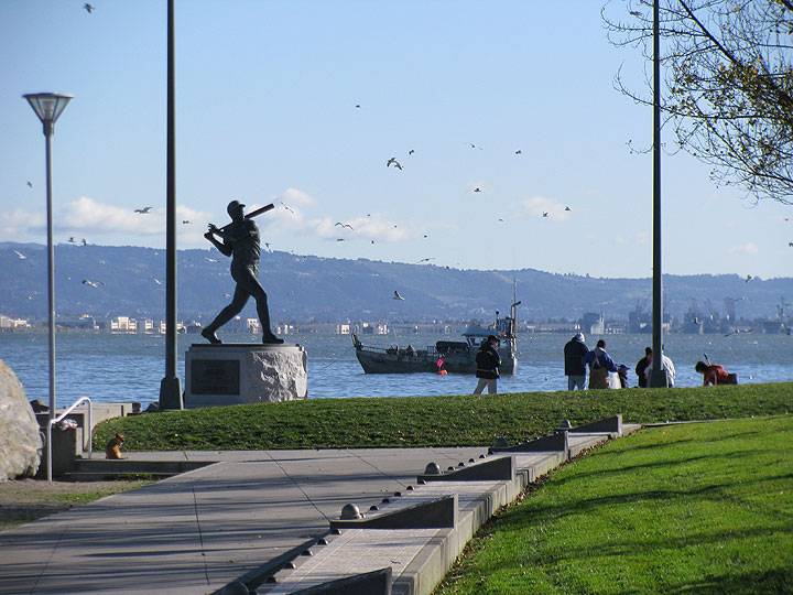
A statue of Willie McCovey at the mouth of the cove that now has his name, at least as designated by the Giants, who not only have the ballpark on the north shore, but a huge development plan for the southern acres adjacent to this small park.
Photo: Chris Carlsson

