Trains in the Mission: Difference between revisions
No edit summary |
(added photo and category) |
||
| Line 30: | Line 30: | ||
''Photo: C.R. collection'' | ''Photo: C.R. collection'' | ||
[[Image:Mission-between-24th-and-25th-2014 6205.jpg]] | |||
'''Same view northerly on Mission. The diagonal white wall at left sits on the old railroad right-of-way, 2014.''' | |||
''Photo: Chris Carlsson'' | |||
[[Image:Mission-rr-crossing-June-4-1905 U00493.jpg|720px]] | [[Image:Mission-rr-crossing-June-4-1905 U00493.jpg|720px]] | ||
| Line 114: | Line 122: | ||
[[United Railroads |Prev. Document]] [[Bernal Cut | |Next Document]] | [[United Railroads |Prev. Document]] [[Bernal Cut | |Next Document]] | ||
[[category:Transit]] [[category:1920s]] [[category:1930s]] [[category:1900s]] [[category:Mission]] [[category:Bernal Heights]] [[category:Noe Valley]] [[category:1870s]] [[category:1940s]] [[category:1850s]] | [[category:Transit]] [[category:1920s]] [[category:1930s]] [[category:1900s]] [[category:Mission]] [[category:Bernal Heights]] [[category:Noe Valley]] [[category:1870s]] [[category:1940s]] [[category:1850s]] [[category:2010s]] | ||
Revision as of 18:21, 9 May 2021
Unfinished History
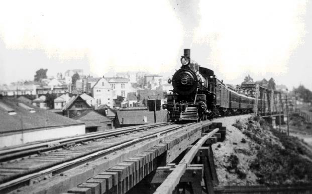
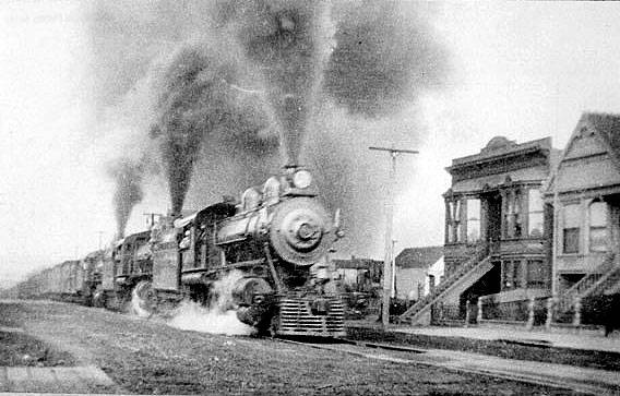
Southern Pacific's San Jose Railroad chugging through the Mission District, c. 1920
Photo: Private Collection, San Francisco, CA
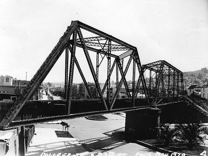
Railroad bridge crossing Dolores at 27th Street, May 1929.
Photo: C.R. collection
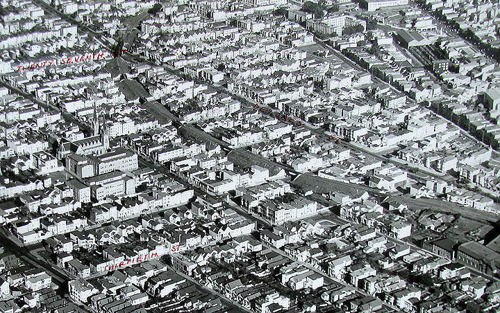
Railroad right of way visibly curving through lower Noe Valley (part of which has been affectionately dubbed "La Lengua" by blogger Burrito Justice) in this early 1940s aerial image. Also notable is the location of the not-yet built Noe Valley Recreation Center on the west end of the block bounded by 30th, Sanchez, and Day Streets.
Photo: San Francisco Planning Department
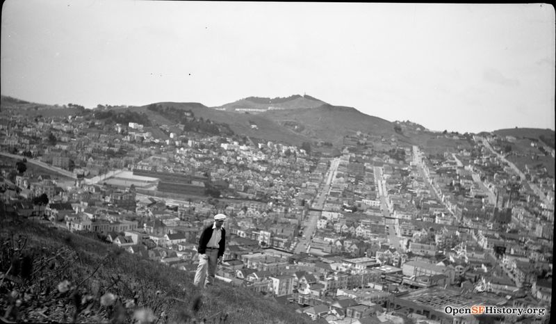
1930s view west from Bernal Heights, elevated railway curving through cityscape in distance. St. Paul's Catholic Church at far right.
Photo: OpenSFHistory.org wnp14.1107
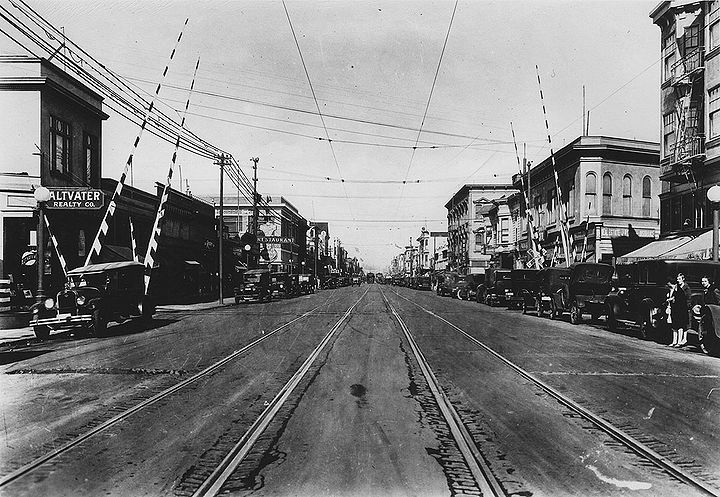
Mission Street north from 25th Street, with the Southern Pacific railroad crossing mid-block between 25th and 24th, seen here in 1926. The building on the northwest corner of 24th and Mission visible at back left of this photo still stands (and houses Dance Mission upstairs, a Chinese fastfood place downstairs), but BART plazas have replaced the structures on the southwest and northeast corners behind the long-vanished railroad crossing in this photo.
Photo: C.R. collection
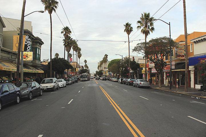
Same view northerly on Mission. The diagonal white wall at left sits on the old railroad right-of-way, 2014.
Photo: Chris Carlsson
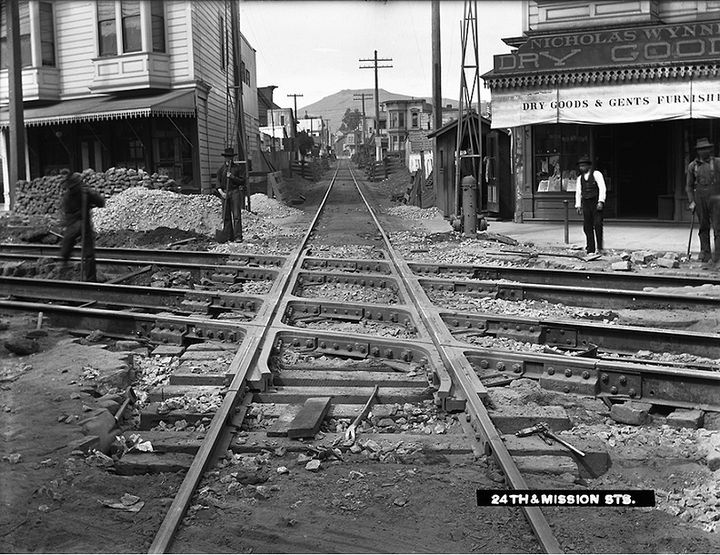
Mission Street between 24th and 25th looking southwest on the Southern Pacific railroad line, June 1905.
Photo: SFMTA
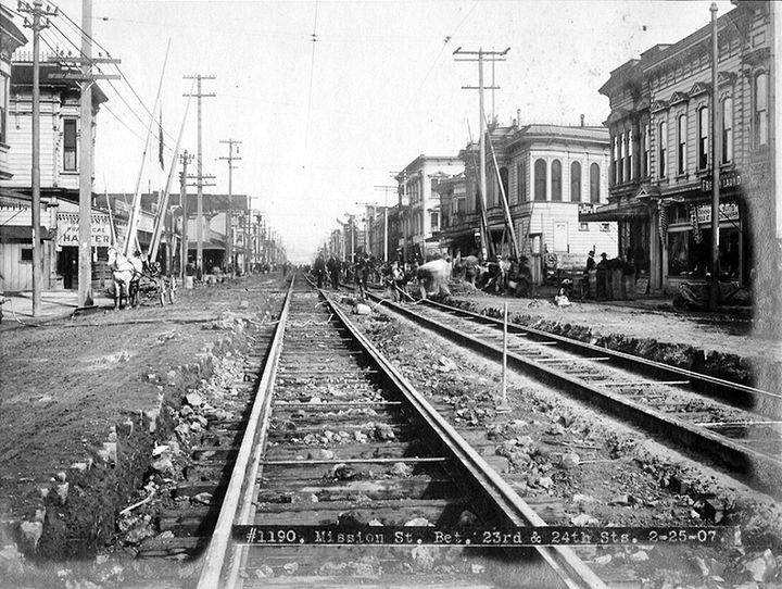
Mission Street between 24th and 25th, February 1907. (Misidentified as being between 23rd and 24th.)
Photo: SFMTA
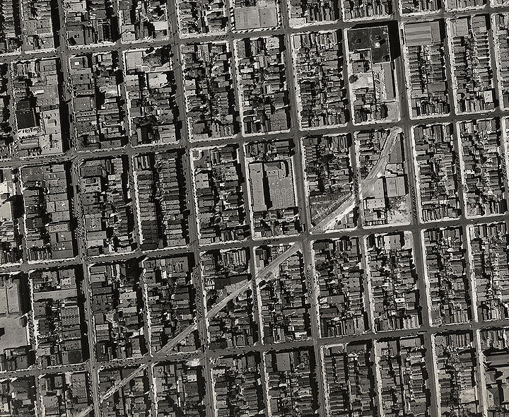
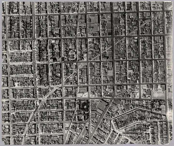
Train route cutting diagonally through the Mission. Where the train line leaves the image at lower left edge of this photo is where the train cuts across Mission Street between 24th and 25th Streets. Photo: 1938
Photo: Harrison Ryker, courtesy David Rumsey collection
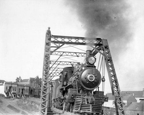
Train on bridge near Dolores Street, 1908.
Photo: San Francisco History Center, San Francisco Public Library
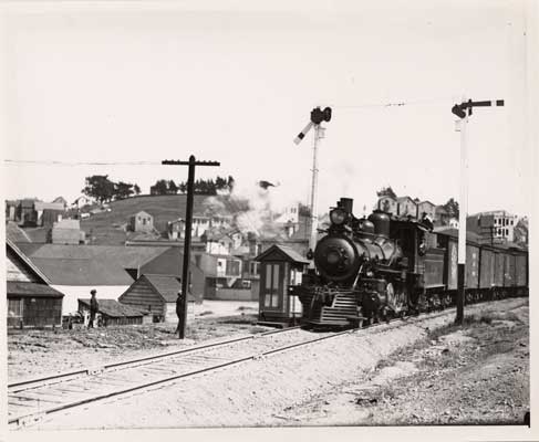
Railroad passing Bernal Cut, 1908.
Photo: San Francisco History Center, San Francisco Public Library
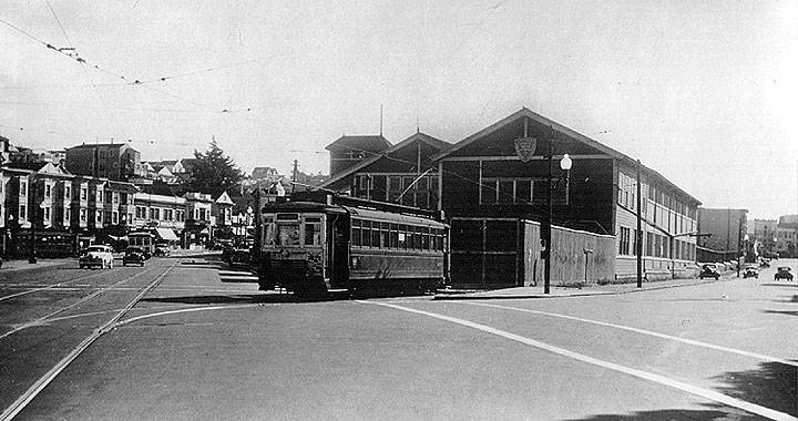
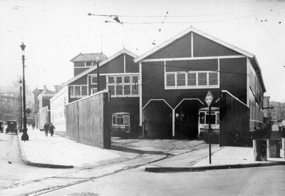
United Railroads carbarn and trolley at Valencia and Tiffany (Mission Street is in distance), 1937.
Photo: Private Collection, San Francisco
Carbarn at Valencia and Tiffany, late '10s-early 1920s.
Photo: San Francisco History Center, San Francisco Public Library
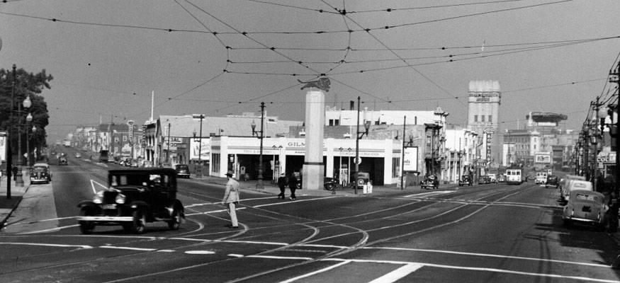
Valencia and Mission streets, August 1944.
Photo: San Francisco History Center, San Francisco Public Library
Southern Pacific train running on Harrison Street near 21st, 1905.
Photo: San Francisco History Center, San Francisco Public Library
29th & Dolores Sts., apx. 1902, railroad bridge in background.
Photo: Private Collection, San Francisco, CA
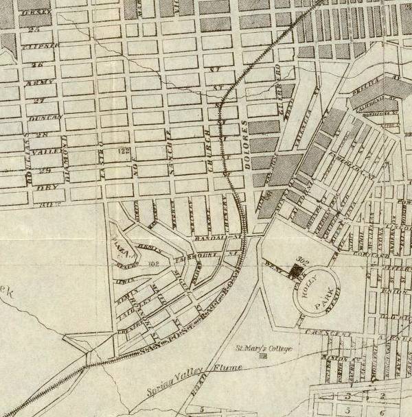
The actual route of the San Francisco-San Jose Railroad through Noe Valley—1873
Photo: David Rumsey Collection
Train route clearly visible through the Mission leading to the Bernal Cut in this 1938 aerial photograph.
Photo: Harrison Ryker, courtesy David Rumsey collection
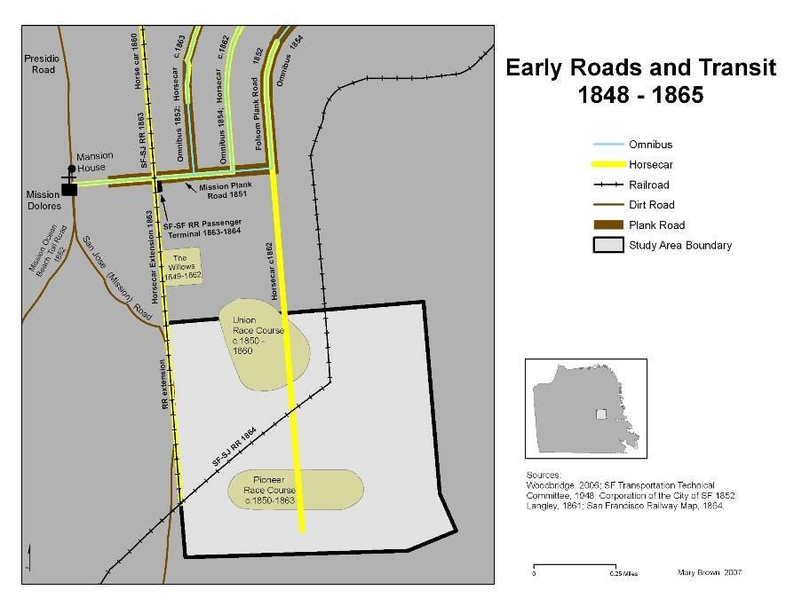
Early roads and train lines 1846-1861
Map: courtesy Mary Brown

