Southern Pacific Roundhouse: Difference between revisions
mNo edit summary |
(moving photo to new page) |
||
| Line 69: | Line 69: | ||
''Photo: Regina Alioto'' | ''Photo: Regina Alioto'' | ||
<iframe src="https://archive.org/embed/mission-bay-railyards-1963-from-lost-landscapes-no-1" width="640" height="480" frameborder="0" webkitallowfullscreen="true" mozallowfullscreen="true" allowfullscreen></iframe> | <iframe src="https://archive.org/embed/mission-bay-railyards-1963-from-lost-landscapes-no-1" width="640" height="480" frameborder="0" webkitallowfullscreen="true" mozallowfullscreen="true" allowfullscreen></iframe> | ||
Revision as of 15:37, 4 April 2023
Unfinished History
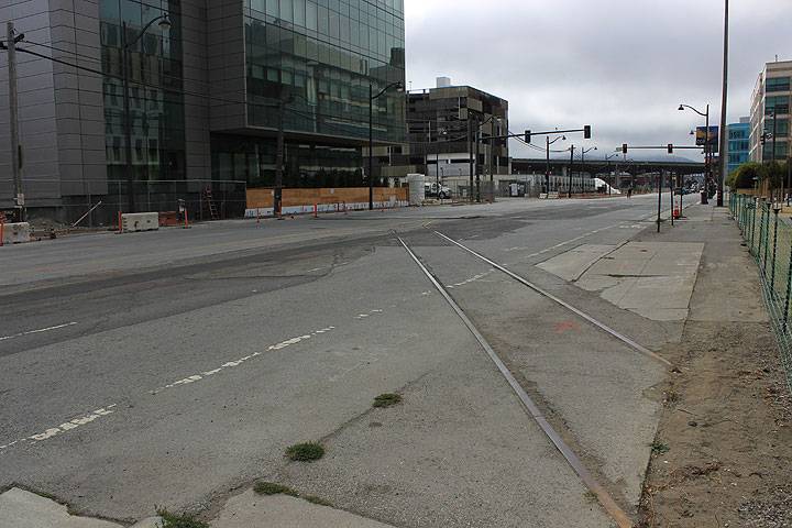
These tracks still crossed 16th Street as the new Children's Hospital was being finished. (They are now gone.) They once were amidst dozens of tracks, and went into the Southern Pacific Roundhouse (which allowed trains to be switched from one track to another) that occupied the land just west of the new hospital.
Photo: Chris Carlsson, 2014.
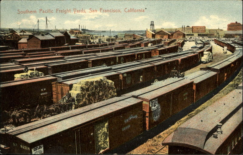
Southern Pacific railyards in Mission Bay, c. 1909.
Photo: Mark Gorney, via Facebook
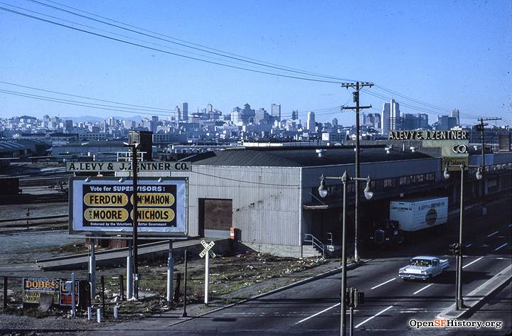
Third Street near 16th Street, November 1963. Tracks visible crossing Third, and filling area behind buildings along street.
Photo: OpenSFHistory.org
Third Street at 16th Street, 2023. Tracks on Third for the T-line light rail.
Photo: Eihway Su
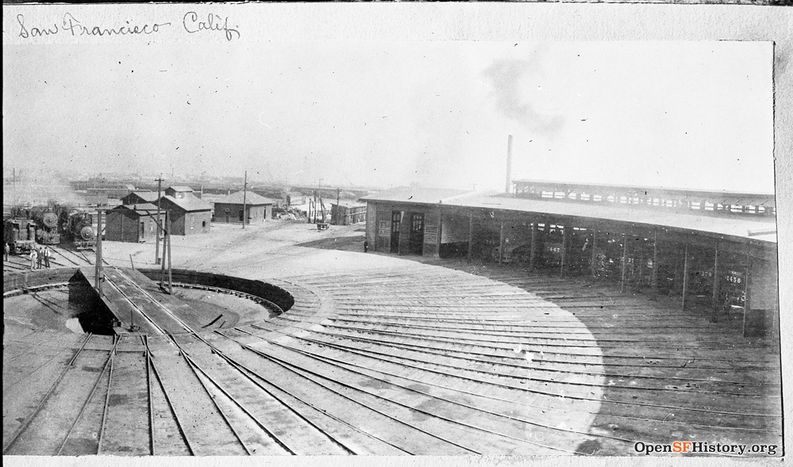
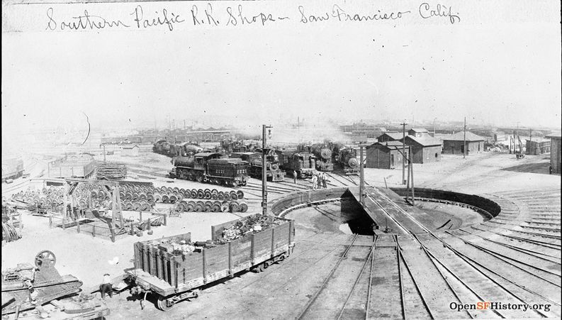
Southern Pacific roundhouse near Mariposa and Minnesota, c. 1910.
Photo: courtesy OpenSFHistory.org wnp33.01022
Southern Pacific roundhouse near Mariposa and Minnesota, c. 1910.
Photo: courtesy OpenSFHistory.org wnp33.01021
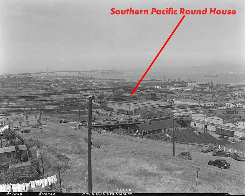
SP Roundhouse at end of arrow, seen here from the viaduct at top of Potrero Hill and 18th, 1942.
Photo: SF Dept. of Public Works
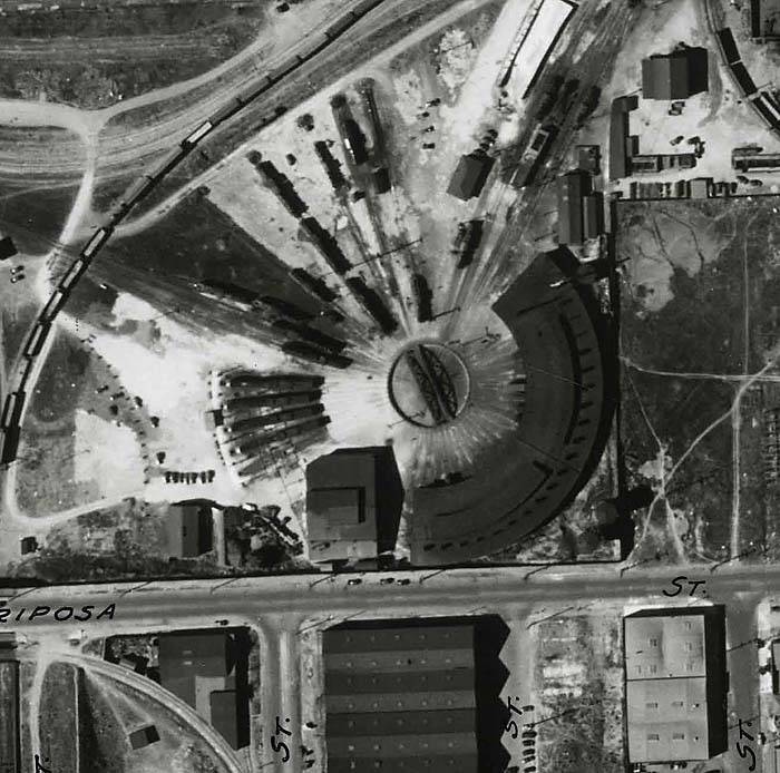
Here is a 1938 aerial photo of the SP Roundhouse; the tracks going diagonally to the upper right correspond to the track in the first photo above.
Photo: Harrison Ryker, courtesy David Rumsey collection
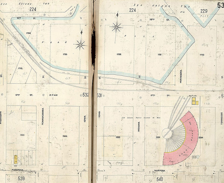
On this 1905 Sanborn insurance map, the SP Roundhouse is clear at the lower right, but remarkably there is still a good deal of Mission Bay in its original watery landscape present in this pre-earthquake rendition.
Photo: courtesy David Rumsey collection
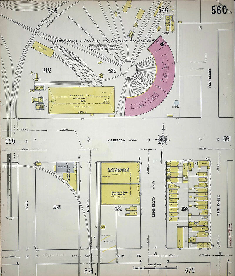
This 1914 Sanborn insurance map shows the SP Roundhouse situated with the streets of Dogpatch all around.
Photo: courtesy David Rumsey collection
The Italian neighborhood on Potrero Hill just south and west of the railyards provided many of the workers for the Southern Pacific. Here are a couple of photos from the collection of Alioto/Firpo family:
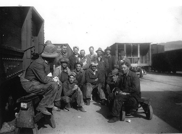
Southern Pacific Roundhouse, 1942. Frank I. Alioto is in the center of the second row.
Photo: Regina Alioto
<iframe src="https://archive.org/embed/mission-bay-railyards-1963-from-lost-landscapes-no-1" width="640" height="480" frameborder="0" webkitallowfullscreen="true" mozallowfullscreen="true" allowfullscreen></iframe>
Ten seconds of aerial view of the Mission Bay railyards in 1963.
Video: Prelinger Archive

