India Basin: Difference between revisions
(added photo) |
(added photos) |
||
| Line 6: | Line 6: | ||
''Photo: Private Collection, San Francisco, CA'' | ''Photo: Private Collection, San Francisco, CA'' | ||
[[Image:Panorama Butchertown-and-Islais-Creek-c-1900.jpg|800px]] | |||
'''Panorama of Butchertown and Islais Creek, c. 1890s.''' | |||
''Photo: George F. Lengeman collection'' | |||
[[Image:View-south-across-India-Basin,-early-1900s.-Wooden-shipbuilding-yards-on-the-shore-and-Hunters-Point-in-far-left-distance..jpg]] | [[Image:View-south-across-India-Basin,-early-1900s.-Wooden-shipbuilding-yards-on-the-shore-and-Hunters-Point-in-far-left-distance..jpg]] | ||
| Line 30: | Line 36: | ||
''Photo: OpenSFhistory.org wnp14.2139'' | ''Photo: OpenSFhistory.org wnp14.2139'' | ||
[[Image:Boy-with-dog-on-HP-peninsula-looking-north.jpg]] | |||
'''Boy with dog on the Hunters Point peninsula looking northward across India Basin, c. 1890s.''' | |||
''Photo: George F. Lengeman collection'' | |||
[[Image:bayvwhp$india-basin-park-1996.jpg]] | [[Image:bayvwhp$india-basin-park-1996.jpg]] | ||
| Line 64: | Line 76: | ||
[[Shipwright's Cottage |Prev. Document]] [[India Basin and the Southeast Bayshore | Next Document]] | [[Shipwright's Cottage |Prev. Document]] [[India Basin and the Southeast Bayshore | Next Document]] | ||
[[category:Bayview/Hunter's Point]] [[category:1910s]] [[category:1920s]] [[category:1950s]] [[category:1990s]] [[category:2000s]] [[category:shoreline]] [[category:Water]] [[category:1900s]] | [[category:Bayview/Hunter's Point]] [[category:1910s]] [[category:1920s]] [[category:1950s]] [[category:1990s]] [[category:2000s]] [[category:shoreline]] [[category:Water]] [[category:1900s]] [[category:1890s]] | ||
Latest revision as of 11:35, 6 June 2023
Unfinished History
1920 view north from Hunter's Point Ridge over India Basin, Union Iron Works, Spreckel's sugar refinery, PG&E oil burning steam powered electrical generating facilities below Potrero Hill in the distance. Islais Creek waters below.
Photo: Private Collection, San Francisco, CA
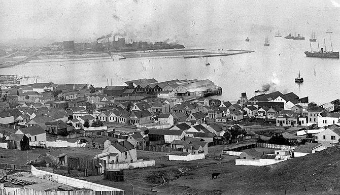
Panorama of Butchertown and Islais Creek, c. 1890s.
Photo: George F. Lengeman collection
View east along southern shore of India Basin, c. 1900. Wooden shipbuilding yards in foreground, and Hunters Point repair shipyard in distance.
Photo: George F. Lengeman collection
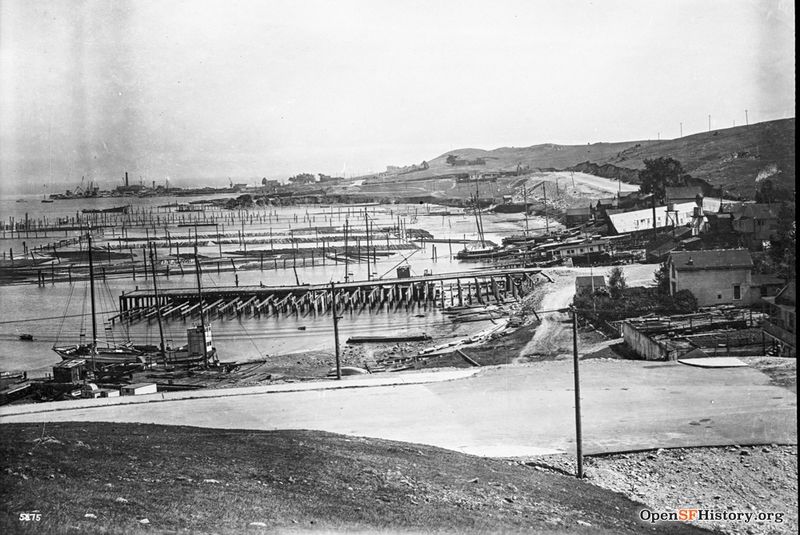
Indian basin, piers along shores of Hunter's Point, some probably belonging to Chinese shrimp fishermen. April 16, 1918.
Photo: OpenSFHistory.org wnp36.01833
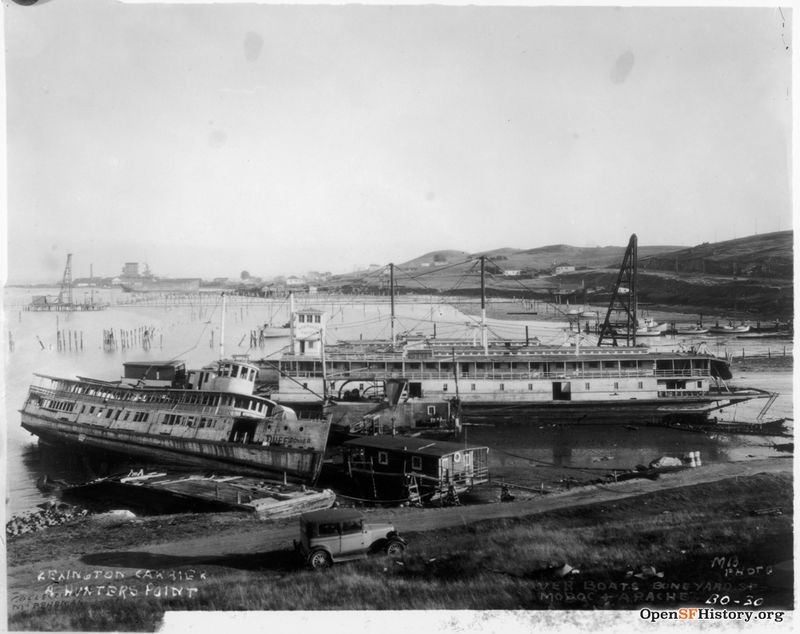
India Basin Shipyards pictured in 1929
Photo: OpenSFHistory.org wnp71.1164
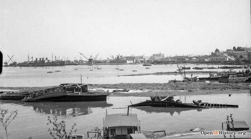
India Basin, 1950s.
Photo: OpenSFhistory.org wnp14.2139
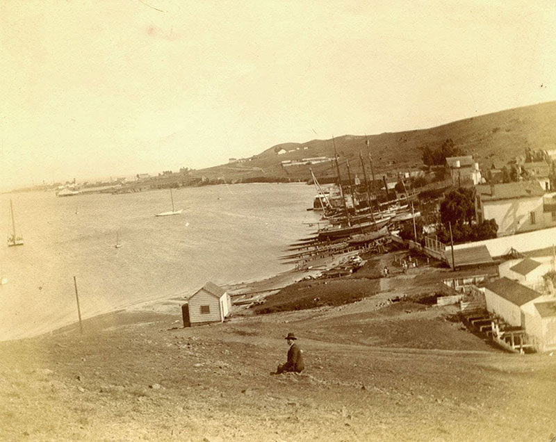
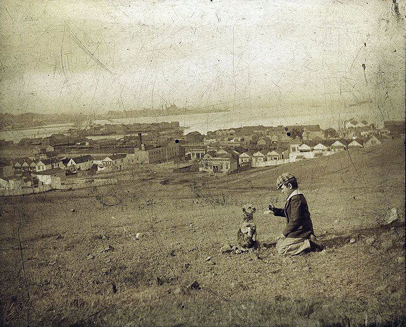
Boy with dog on the Hunters Point peninsula looking northward across India Basin, c. 1890s.
Photo: George F. Lengeman collection
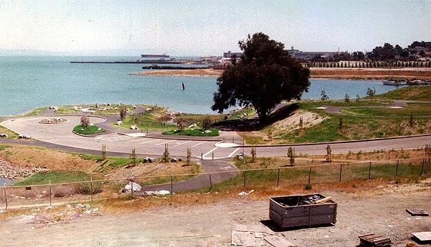
India Basin, pictured here in 1996, where a park was carved out of the industrial shoreline just north of Hunter's Point.
Photo: Chris Carlsson
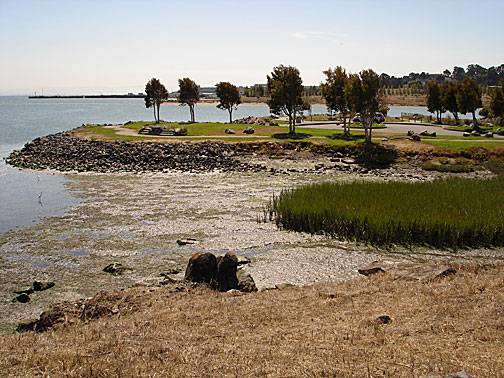
The India Basin park seen in 2005, mudflats and native plants beginning to fill the surrounding waters.
Photo: Chris Carlsson
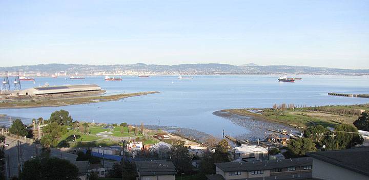
India Basin as seen from above on Hunters Point Hill, December 2012.
Photo: Chris Carlsson
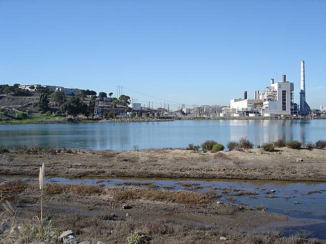
The southeastern shoreline is also home to a number of indigenous plants and a restored habitat, the PG&E plant before its demolition on shoreline.
Photo: Chris Carlsson

