18th St Gulch, The Willows, Valencia St Hotel
Historical Essay
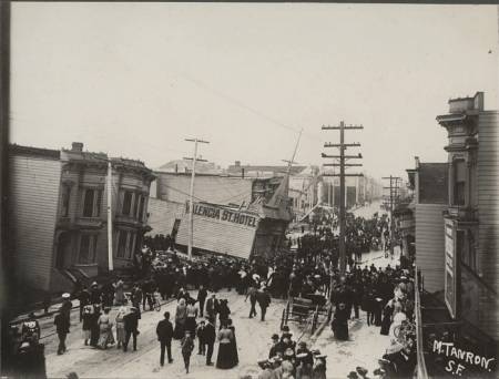
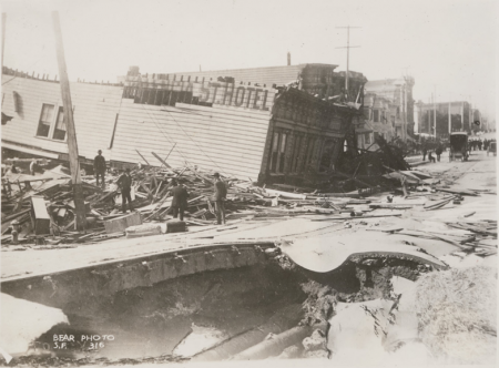
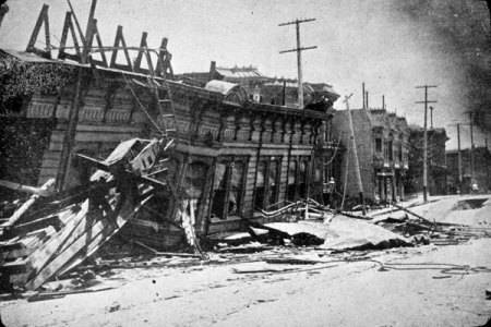
“When the quake struck, patrons in an all night coffee shop on the bottom floor of the four-story hotel ran from the building just in time to watch the building simultaneously lurch forward and sink, making the hotel’s fourth floor the hotel’s only floor above ground.”
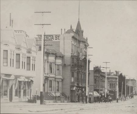
The hotel before the quake:
Photos: Bancroft Library
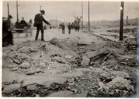
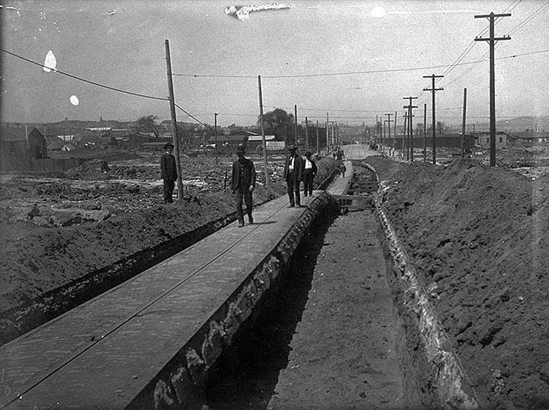
A sinkhole opened up later, right where all those people were standing. Reader Dave Dennison points out that the sinkhole was due to a broken water main, and at least 40 people drowned.
(All these years I thought these shots with the Valencia St Hotel on the left were looking south, but I was wrong — they are to the north. It certainly makes the above shot with the approaching fire make more sense.)
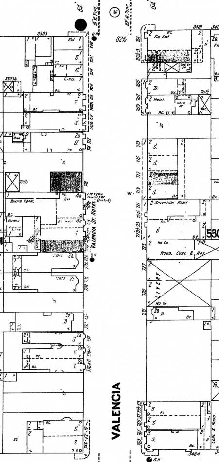
Here’s the 1899 Sanborn map of Valencia between 18th and 19th. You can see the two big water mains, 22″ and 16″, running down Valencia.
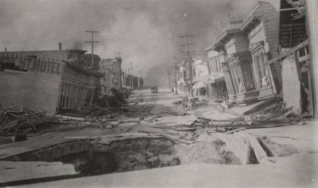
Another view of the sinkhole – you can see the water mains.
The steeple in the first two shots aren’t visible in the picture below, or in the sinkhole shot. There was a 5.0 aftershock at 2:25pm on the 18th. Did it come down in the aftershock or during the rescue attempts?
Photo: SF Museum
Soon after these pictures were taken, fire swept through the area. Those still trapped who didn’t drown, well…
Photo: San Francisco History Center, SF Public Library
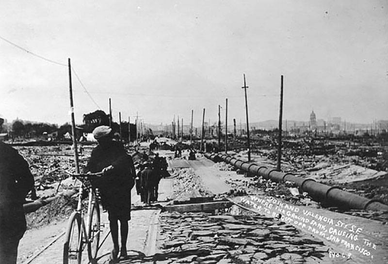
20th and Valencia where the ground sank in 1906.
Photo: San Francisco History Center, SF Public Library, AAC-3551
North on Valencia Street between 18th and 19th after the fire of April 18, 1906.
Photo: Shaping San Francisco
More on the Valencia St Hotel here.
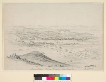
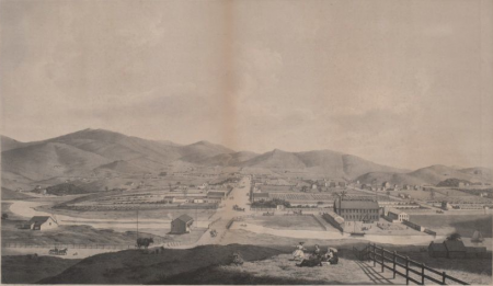
The “18th St Gulch” (for the lack of a better term — feel free to come up with a catchier name) was bigger than I realized. This sketch of the Mission from the 1850 looks NE from around 21st and Liberty and gives some indication of its depth.
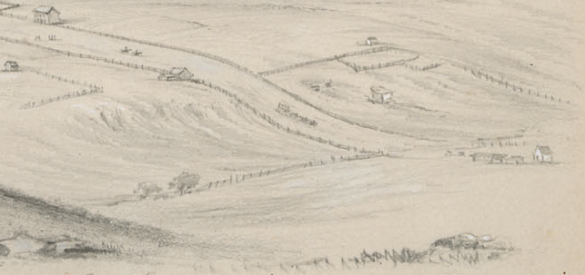
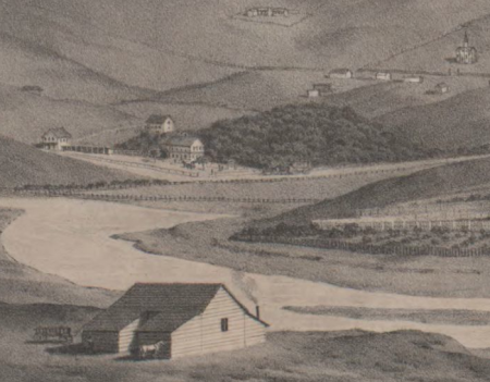
Zooming in on the bottom right, we see the gulch at what will be Dolores and 18th, with a stagecoach hurtling out of control (ok, probably not, as it’s not even the steepest part).
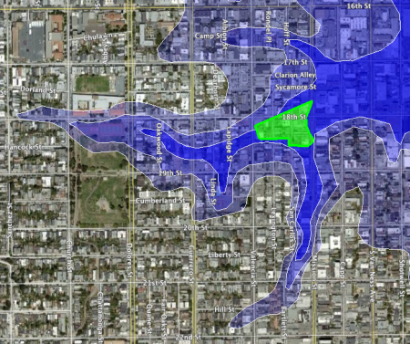
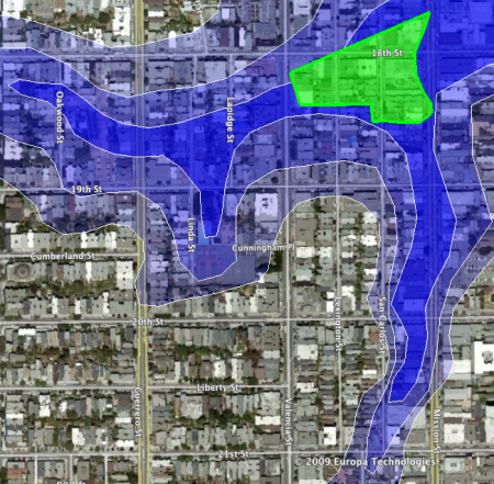
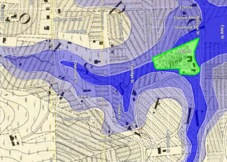
I traced the topology contour lines from the 1859 US Coast Survey Map and made quick and dirty overlays to show just how much was filled in before the 1906 quake. Each color gradient is a 20 foot change.
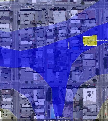
The gulley dropped over 40 feet in half a block! At roughly 12 feet per storey, that pretty much explains where the Valencia St Hotel went. (The green area is the Willows beer garden from the 1850s/60s, and the Valencia St Hotel would later be built on the bottom left corner.) Zooming in a bit:
Note also the gulley along the west side of mission between 21st and 18th, as well as between Lapidge and Linda.
Here’s the overlay of the Valencia St Hotel on the gulch map. (Valencia on the right, Guerrero on the left).
This litho of the Mission in 1860 looks west from around what is now Mariposa and Utah (via Calisphere):
Zooming in on the left we see the steep ascent above Mission Creek, with the Willows in front of the trees. The road in front of the Willows is what will be Mission Street. (via Calisphere).
Here’s the 1859 US Coast Survey Map. The building on the bottom left of the map (and the top center of the lithograph) may be the Jewish Cemetery. If so, Dolores Park would be to the right on the lithograph.
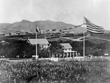
The background of this picture of the Willows in the 1864 taken from the Union Race Course (via SFPL) gives some indication of the slope.
I leave it as an exercise to the reader to determine where not to buy a house (or invest in a sound foundation).

