Yerba Buena Cove
Primary Source
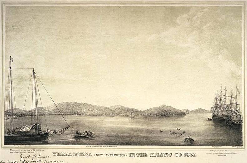
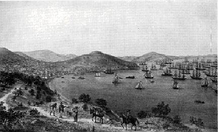
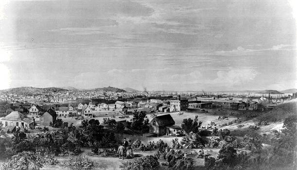
Yerba Buena Cove, spring 1837.
Image, courtesy John Alioto
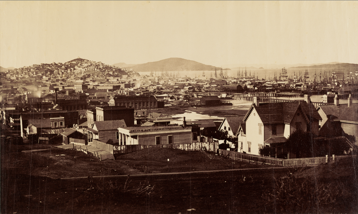
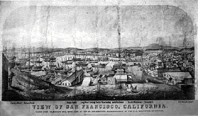
View north from Rincon Hill across the urbanizing Yerba Buena Cove, mostly filled but still some areas of water visible in this 1860 image.
Photo: J. Paul Getty Museum Open Content Program
1849 map of Yerba Buena cove and early San Francisco.
Provenance unknown
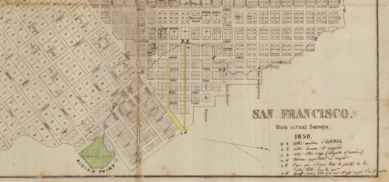
1850 map with Rincon Point and original Yerba Buena shoreline.
Map: Shaping San Francisco
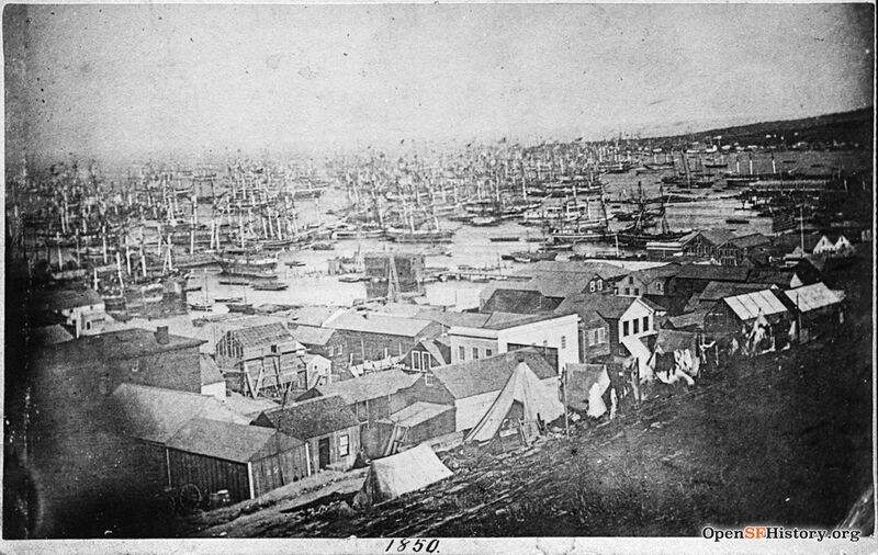
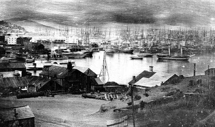
1850s view of Yerba Buena cove from north to south.
Photo: OpenSFHistory.org wnp37.02585
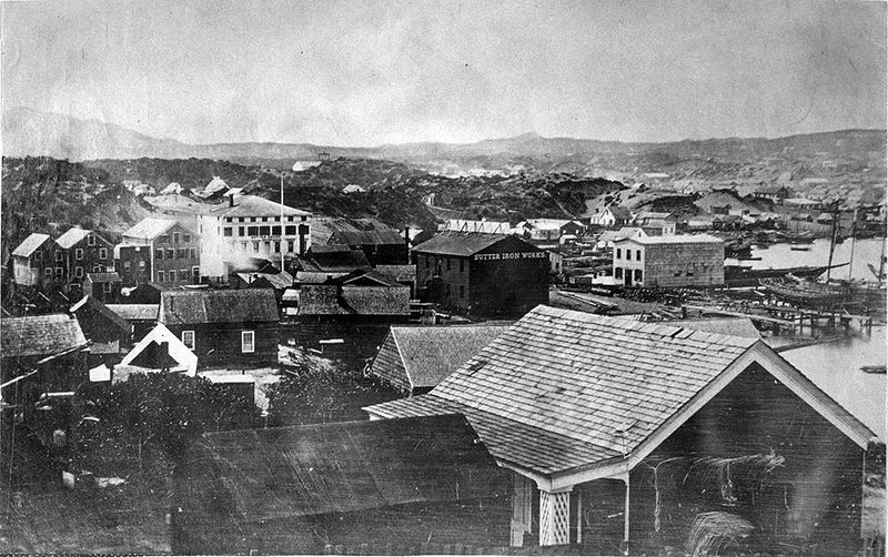
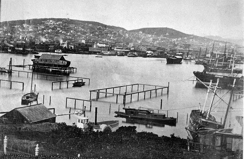
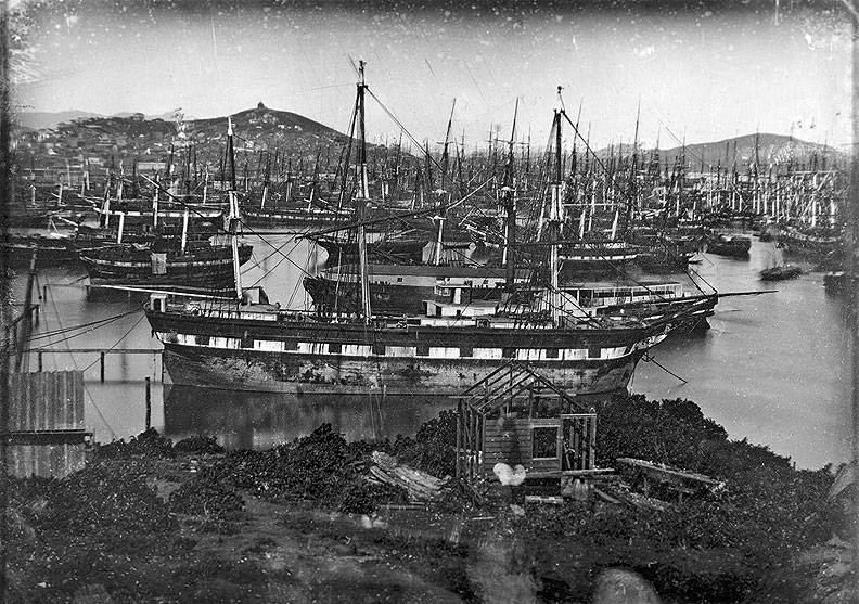
William Shew panorama of San Francisco, 1852, from 2nd and Beale to Rincon Hill, over this and the next four panels.
Photo: Online Archive of California I0012587A
Panel 2, here you can see privately purchased water lots being demarked by wooden poles.
Photo: Online Archive of California I0012588A
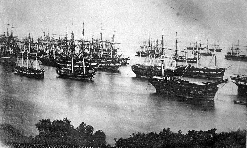
Panel 3: 1852 William Shew daguerreotype of ships in Yerba Buena cove.
Photo: Online Archive of California I0012589A
Panel 4
Photo: Online Archive of California I0012590A
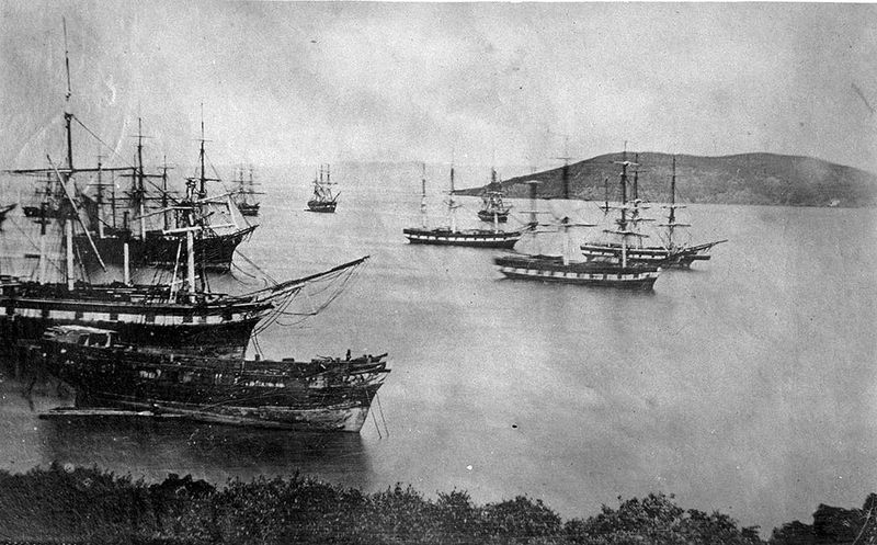
Panel 5: Ships at anchor in Yerba Buena Cove with Yerba Buena Island in distance.
Photo: Online Archive of California I0012591A
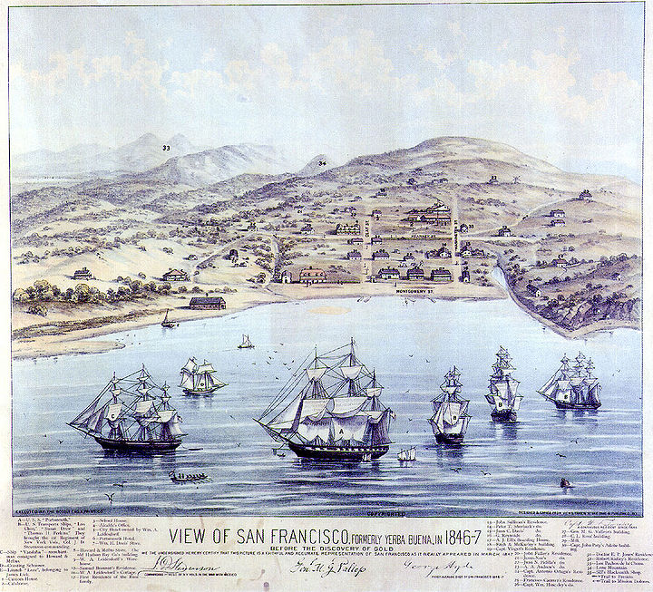
The village of Yerba Buena in 1846, three years before the Gold Rush and the name change to San Francisco. Montgomery St. between Clay & Washington is the shoreline.
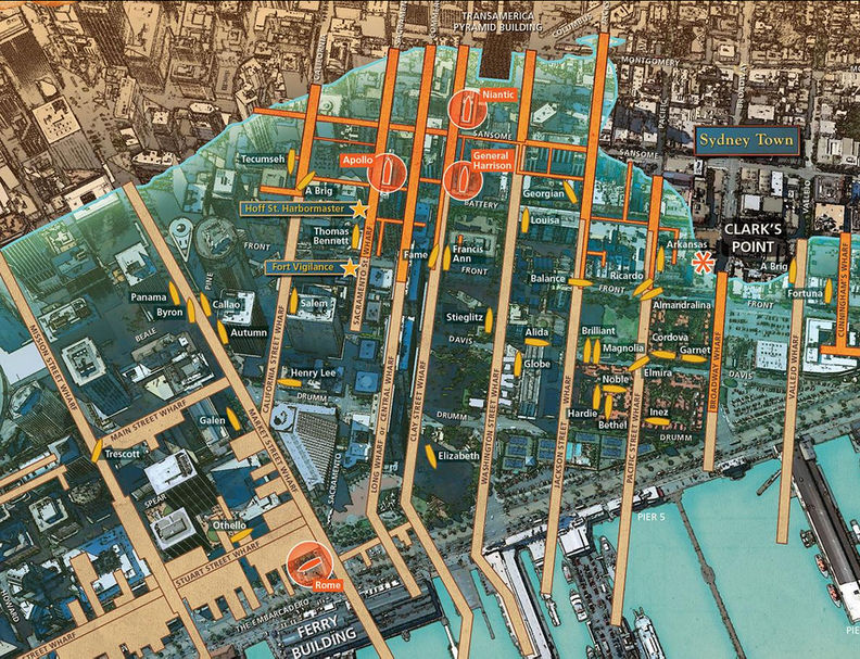
Buried ships map as presented at "The Waterfront" exhibit at the Visitor's Center of the National Maritime Museum.
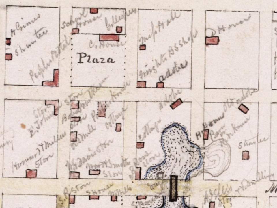
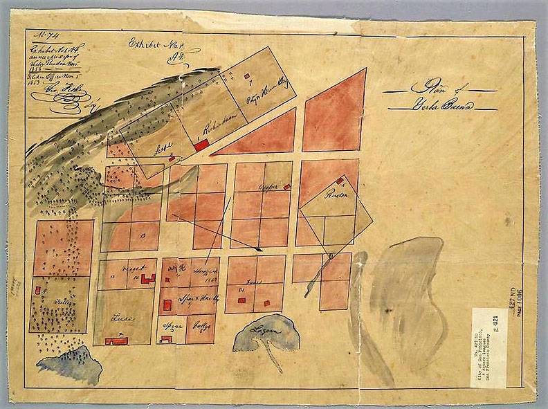
Property map of Yerba Buena cove in the late 1830s, still the pueblo in Mexico's Alta California.
Image: via John Alioto
Yerba Buena Cove in 1849.
Image: California Historical Society, San Francisco, CA
Yerba Buena Cove in 1850, looking towards Telegraph Hill from Rincon Hill.
Image: California Historical Society, San Francisco, CA
DESCRIPTION OF YERBA BUENA COVE IN 1833
W. Davis, an East Coast captain, describes Yerba Buena Cove in 1833:
"We anchored in a cove known as Yerba Buena. Telegraph Hill was then called Loma Alto. At that time there were some half dozen barks from Atlantic ports trading along the California coast, Alaska and the Hawaiian Islands. All that time, Captain Mariano G. Vallejo, later General Vallejo, was in command of the Presidio. The population of the post was about two hundred and fifty men, women and children. The soldiers were Spanish, and all vaqueros. At that time Captain Vallejo had recently married Donna Francisca Benicia Carrillo. Fort Point was then garrisoned and known as Punta de Castillo, or Castle Point. A small number of foreigners were living near the post, among them Captain William A. Richardson, who owned the Sausalito ranch, and who was married to the daughter of the late Captain Ygnacio Martinez, who had been in charge of the Presidio post preceding Captain Vallejo, John Read of Ireland, owner of the Read ranch adjoining the Sausalito ranch, Tim Murphy and James Black, the latter of Scotland."
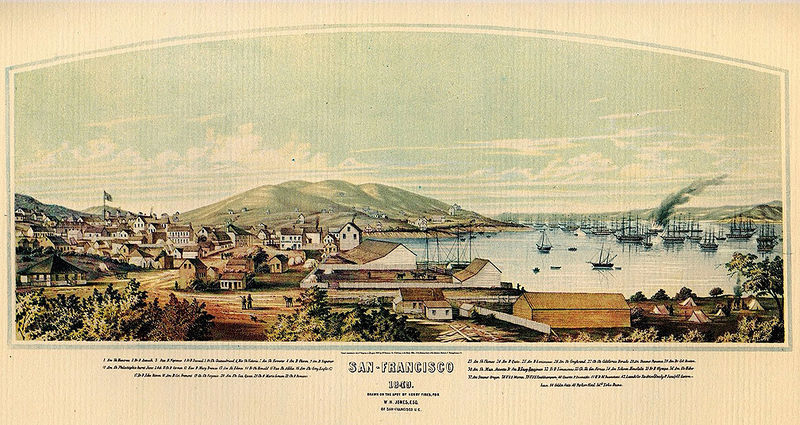
San Francisco, 1849.
1851 view of Yerba Buena Cove from Rincon Hill, with the Vulcan Foundry, founded by George Gordon, at lower left.
Photo: Shaping San Francisco
Looking north at area occupied by downtown in the late 20th century. View is from Rincon Hill 1853 (now western anchor for the Bay Bridge)
Photo: Private Collection, San Francisco, CA
<iframe src="https://archive.org/embed/ssf30CVBRST" width="640" height="480" frameborder="0" webkitallowfullscreen="true" mozallowfullscreen="true" allowfullscreen></iframe>

